HEAT ALERT: Vicious heat continues, strong storms possible
More heat tomorrow will lead to more severe storms tomorrow evening.
More Stories

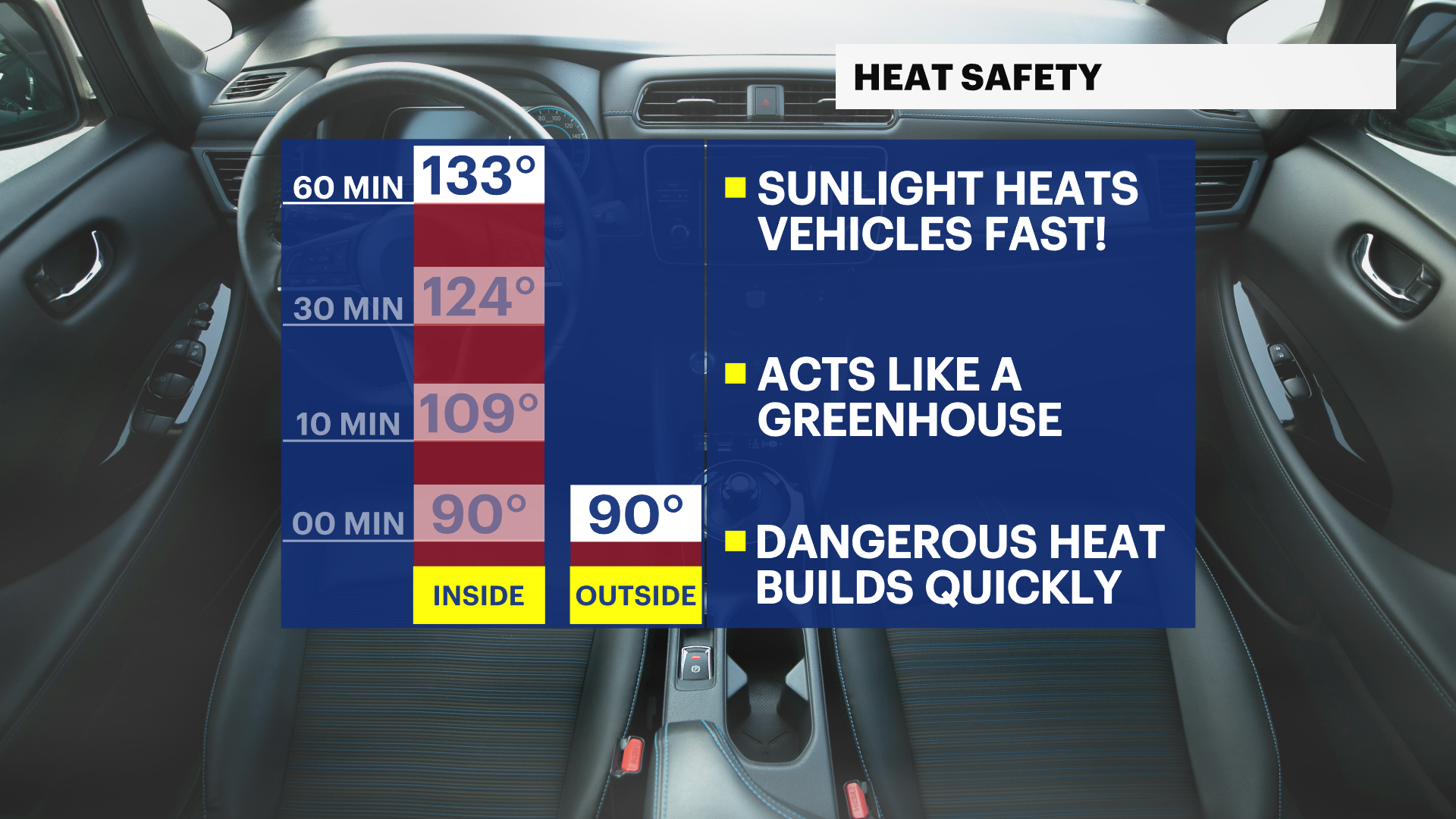

Blistering temperatures will continue once again for the holiday. The Fourth is no stranger to wicked heat. This holiday though is coming into its third consecutive day with afternoon highs at 100 degrees or hotter. THAT is unusual.
Storms tore through the state this evening. hundreds of thousands of residents are left with no power tonight. Severe winds gust from 45 to 70 mph. The outflow of thunderstorms fanned in out ahead of the mainline of severe weather. Winds gusted to 20 and 30 mph consistently before the main line of weather approached. The outflow was created by rain cooled air and the intense column of hot air the rain fell in. While temperatures have cooled down behind the rain, the humidity is even more smothering. It is not the night to be without power.
The Fourth will feature more early sunshine leading to a very quick pop in temperatures. Afternoon highs will once again level off around 100 degrees or hotter. It certainly feels hotter because that tropical air continues to hang over the state. The atmosphere is very unstable, and the likelihood of more severe weather is likely again tomorrow evening and tomorrow night.
RELATED: PSE&G Power Outage Map
RELATED: JCP&L Power Outage Map


