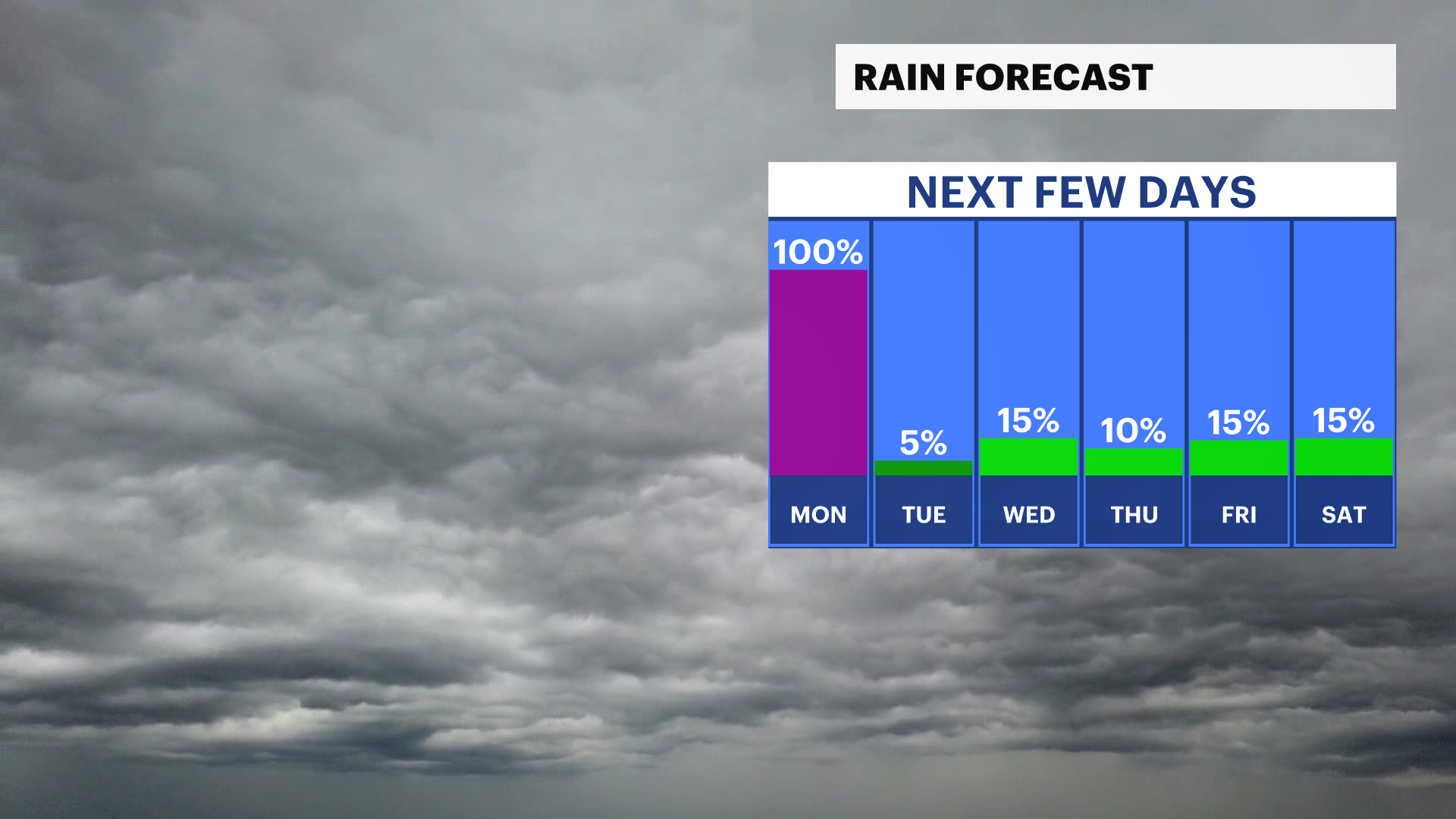
STORM WATCH: Rain is likely this morning, but improvements for the second half of our Memorial Day
Widespread fog is expected this morning with downpours lingering until noontime. The rest of the day, and most of the next 10-days will be dry
More Stories


WHAT TO KNOW
A gloomy morning is expected with widespread fog and drizzle through our early hours followed by a period of steady rain that could be heavy at times late morning until noon-time. The rain will taper off this afternoon and temperatures will return to the 70s with mainly cloudy skies. The rest of the week looks very nice with just a chance for isolated showers
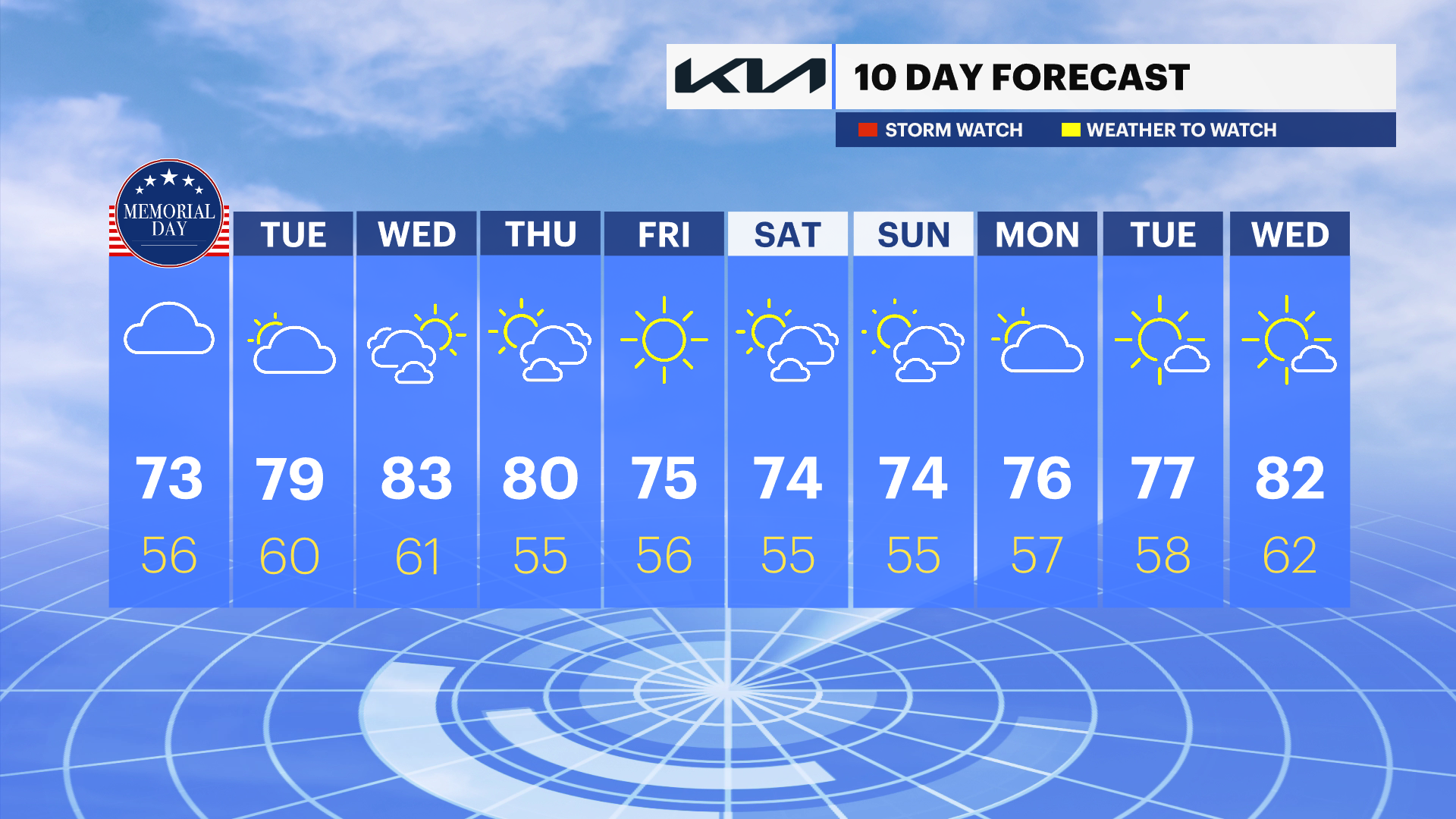
FORECAST
Today - Memorial Day
Memorial Day starts off gloomy and wet, but improves throughout the day. Expect overcast skies this afternoon with peeks of sun west by mid afternoon. High temperatures around 70-degrees.
Tuesday
Mostly cloudy to start with more sun gradually developing later in the day. Highs in the upper 70s or near 80-degrees. Wind light from the southwest at 5 mph.
Wednesday
A touch more sun and much warmer. Temperatures will be in the low to mid-80s. An isolated shower or storm is possible late in the day or overnight hours.
Thursday
Mostly sunny and pleasant, with afternoon temperatures near 80 degrees.
Friday
Mostly sunny and comfortable, with temperatures reaching the mid-70s. A stray shower is possible in the morning.
Marine Forecast
Expect generally poor marine and beach conditions through Monday. A persistent onshore (easterly) wind will keep seas elevated with gusts around 20–25 knots, supporting rough surf and Small Craft Advisory conditions on the ocean waters. Rain will remain likely at times, further limiting visibility and overall comfort for boaters. In addition, a strong easterly swell will maintain a high risk of rip currents and dangerous surf, making swimming hazardous even as conditions begin to improve later Monday.
Conditions turn more favorable by Tuesday, with winds and seas subsiding and a trend toward warmer, drier weather. That will be the better opportunity for boating and beach activities as marine conditions become much more manageable.