STORM WATCH: Another chance of severe thunderstorms tonight for New Jersey
New Jersey will see a steamy, stormy finish to the weekend.
Jul 4, 2026, 12:10 PM
•
Updated
More Stories


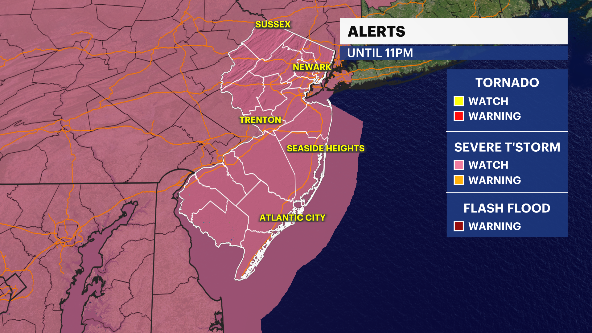
SEVERE THUNDERSTORM WATCH UNTIL 11 PM
FORECAST:
Tonight: Another round of strong to severe thunderstorms is possible across New Jersey following a similar pattern to Friday's storms that produced damaging wind gusts in parts of the state. Any storm that develops could bring frequent lightning, torrential downpours and wind gusts up to 60 mph. If you hear thunder, head indoors immediately as lightning can strike up to 10 miles away from a storm. Strong winds may also cause flying debris, topple small trees and bring down branches. The severe threat should diminish by around 9 p.m., but evening outdoor events and fireworks displays could still face disruptions.
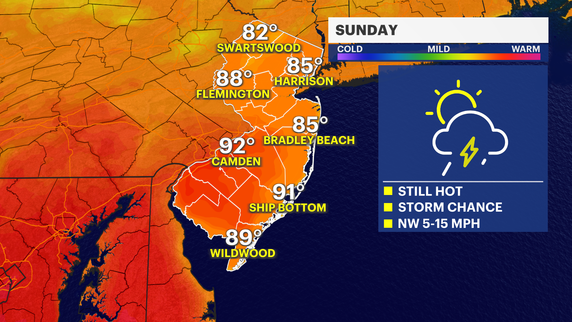
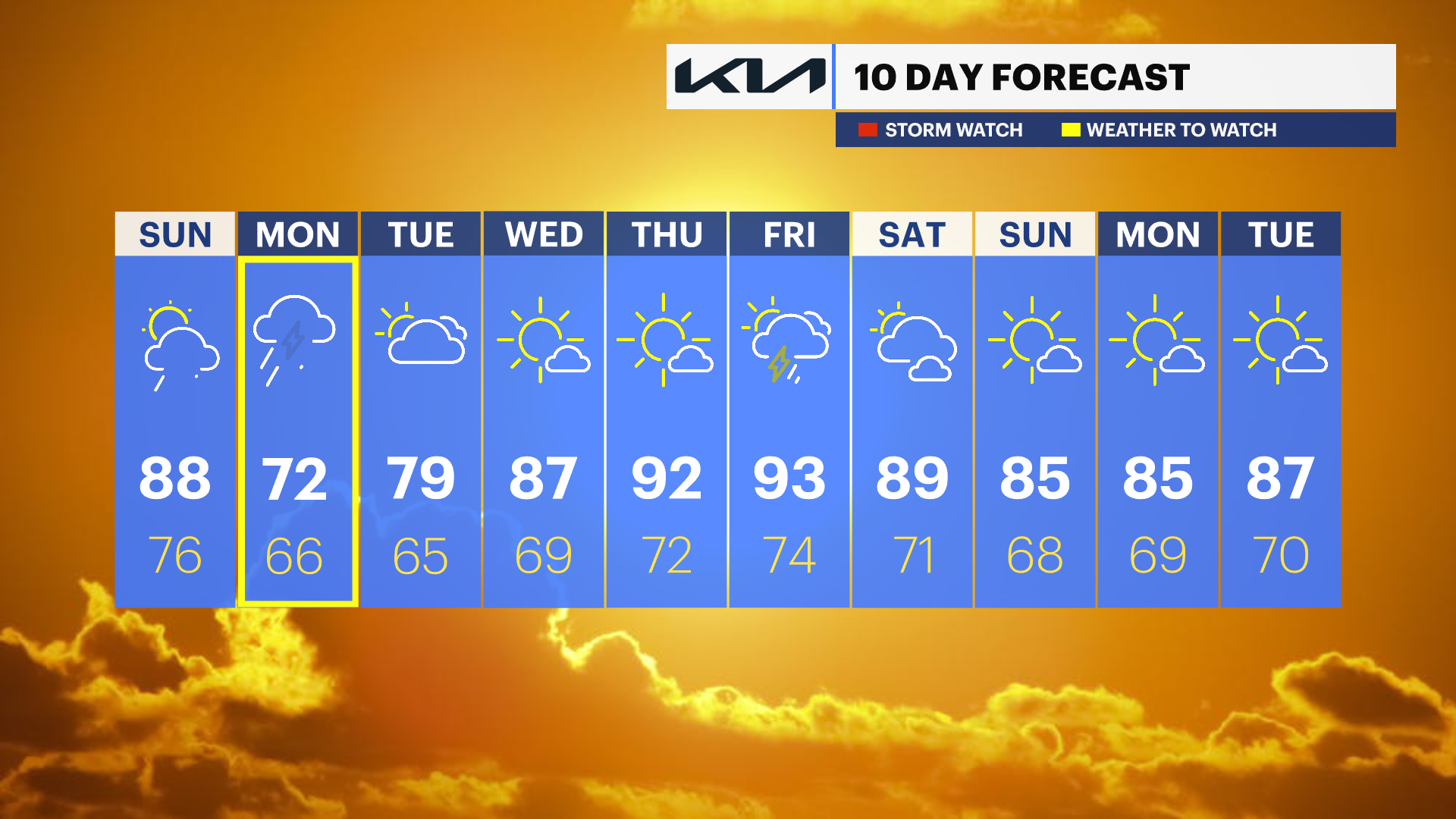
Sunday: Relief arrives as the extreme heat breaks, with temperatures returning to the upper 80s. While still warm and humid, conditions will be far less oppressive. Another round of scattered thunderstorms may develop during the afternoon and evening.
Monday and Beyond: A more widespread period of rain is expected to arrive Monday, bringing the potential for heavy downpours and a wet start to the upcoming workweek. While outdoor plans could be impacted, the region can certainly use the rainfall. Stay with News 12 for the latest forecast updates and any severe weather alerts.
RELATED: PSE&G Power Outage Map
RELATED: JCP&L Power Outage Map


