A cold night then, a big warmup ahead for the Hudson Valley
Clear and chilly conditions settle in overnight, but a steady climb leads to 60s this weekend and a potential surge into the 70s and 80s early next week.
More Stories


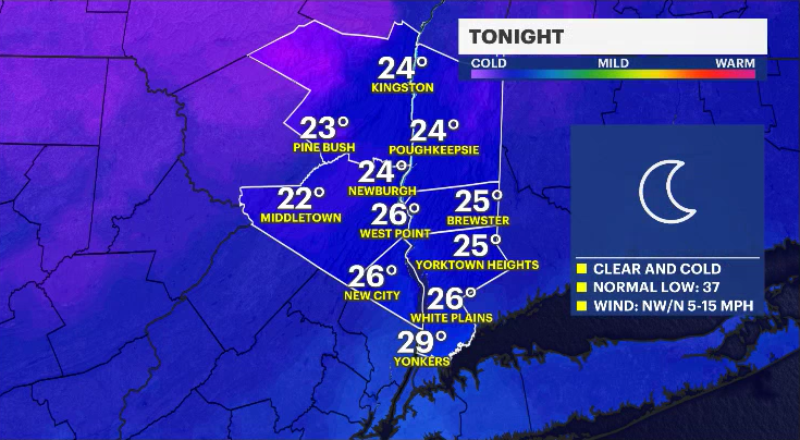
The skies overnight will be clear as winds ease. It will turn cold across the Hudson Valley, with overnight lows dropping into the low to upper 20s. The average low this time of year is around 37 degrees.
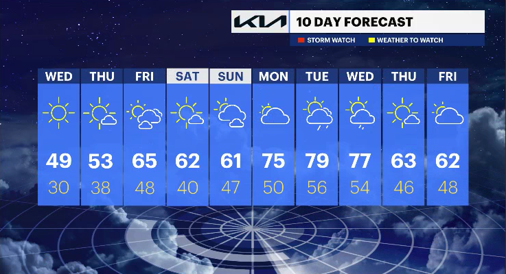
A very cold Wednesday morning is still expected, with temperatures falling into the 20s before warming into the 40s during the afternoon. It will be less windy, but still the coldest day of the week under mostly sunny skies.
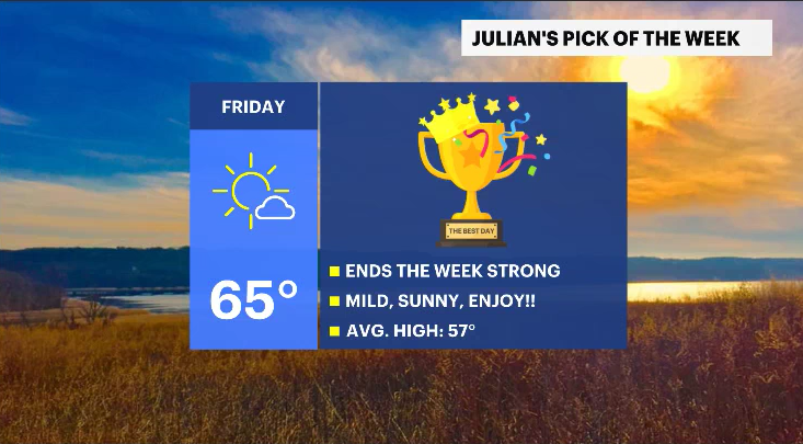
High pressure remains in control over the next several days, keeping conditions dry with plenty of sunshine. Temperatures will gradually warm from Thursday into the weekend. Friday will be the pick of the week as it is expected to be the warmest day, with highs in the 60s. Saturday and Sunday will remain mild, also in the 60s.
A significant warmup is expected early next week. High temperatures could surge into the 70s and possibly the 80s from Monday into Tuesday, ahead of the next system that may bring a cooldown by Tuesday night into Wednesday.
THE FORECAST:
OVERNIGHT: Clear and cold.
Lows: Low to upper 20s.
WEDNESDAY: Mostly sunny and chilly.
Highs: Upper 40s to low 50s.
Lows: Upper 20s to low 30s.
THURSDAY: Mostly sunny and seasonable.
Highs: Low to mid-50s.
Lows: Upper 30s.
FRIDAY (PICK OF THE WEEK): Mostly sunny, mild, and pleasant.
Highs: Mid-60s.
Lows: Mid-40s.