STORM WATCH: Ian’s remnants expected to bring heavy rain to parts of New Jersey
Parts of New Jersey are expected to see heavy rain this weekend related to the remnants of Hurricane Ian.
•
Sep 30, 2022, 10:50 AM
•
Updated 707 days ago
Share:
More Stories
2:30

Chilly morning, pleasant afternoon Sunday in New Jersey
34m ago2:26

The best time of the year to view Saturn is on Sunday when the planet will be in opposition
22h ago1:39

Why has hurricane season quieted down?
yesterday1:13

Will it rain this Labor Day? The News 12 Storm Watch Team breaks it down
7ds ago
LIVE BLOG: News 12 weather updates
10ds ago1:04

Cooler temperature trend into start of meteorological fall
10ds ago2:30
Chilly morning, pleasant afternoon Sunday in New Jersey
34m ago2:26
The best time of the year to view Saturn is on Sunday when the planet will be in opposition
22h ago1:39
Why has hurricane season quieted down?
yesterday1:13
Will it rain this Labor Day? The News 12 Storm Watch Team breaks it down
7ds agoLIVE BLOG: News 12 weather updates
10ds ago1:04
Cooler temperature trend into start of meteorological fall
10ds agoParts of New Jersey are expected to see heavy rain this weekend related to the remnants of Hurricane Ian.
Storm Watch Team Meteorologist Michele Powers says the worst of the rain is expected on Saturday.
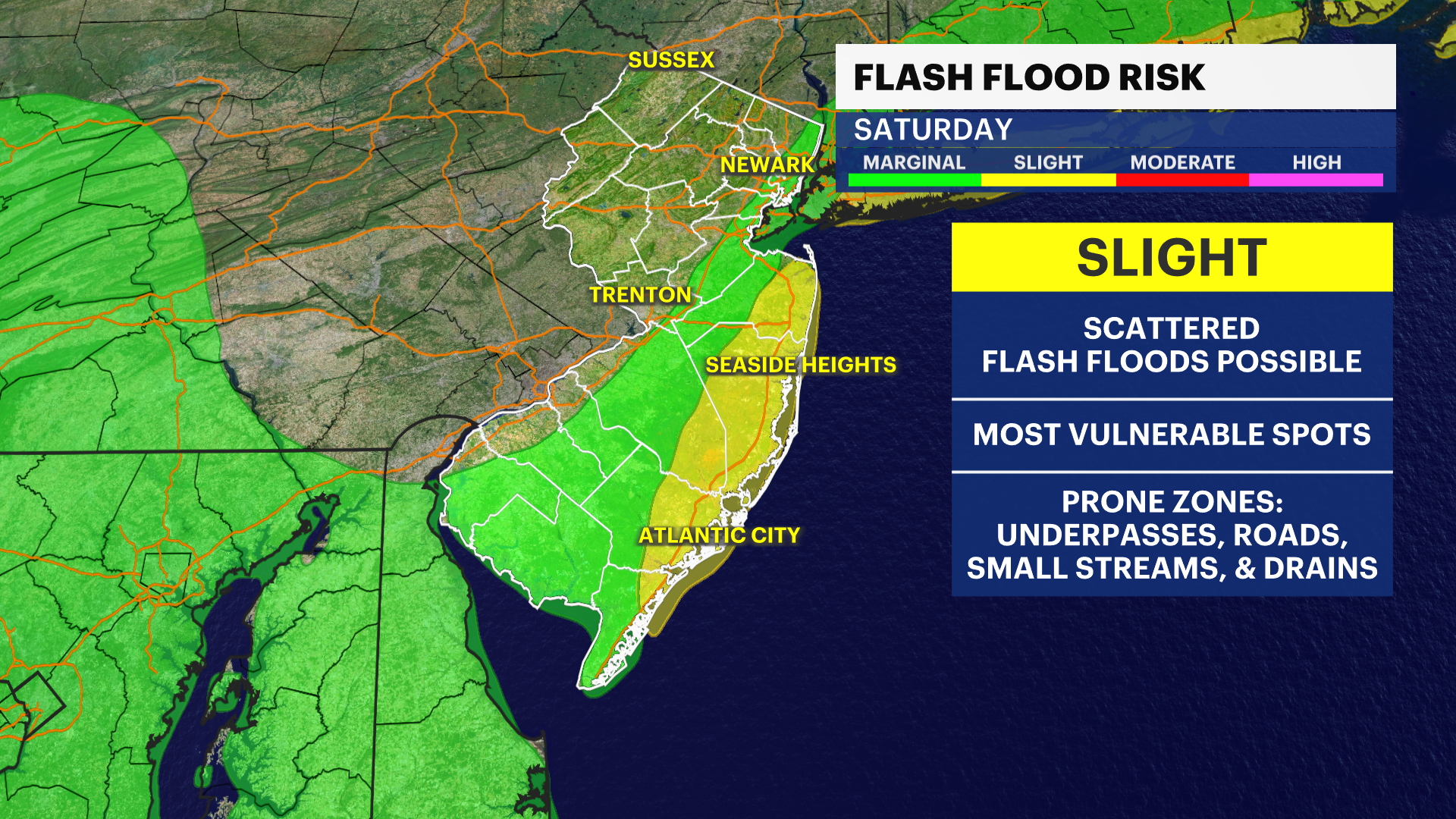
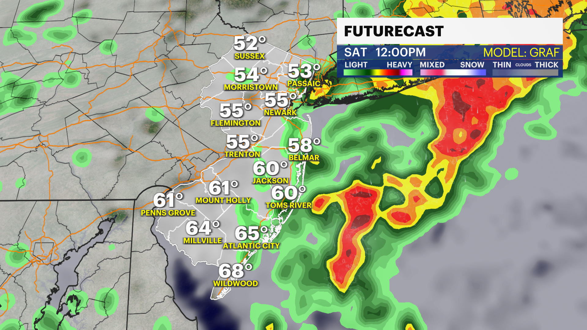
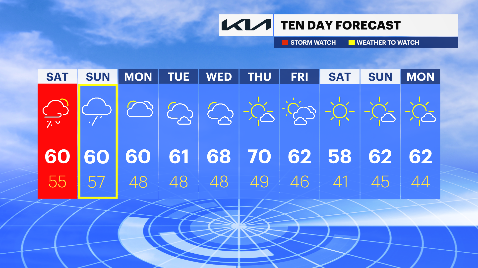
WHAT’S NEXT: Worst of rain starts late Friday night into Saturday morning. Coastal flooding also a concern. Weekend expected to see heavy rain, strong wind gusts and potential for flash flooding. Coastal flood advisories last from around 10 a.m. Saturday through Monday.
OVERNIGHT: Rain begins to fall in parts of the state. Overnight lows dip into the low-50s.
LIVE BLOG: News 12 weather updates

SATURDAY: Heavy rain in the early morning, followed by on-and-off showers and drizzle throughout the day. Wind gusts could reach up to 20-30 mph. Daytime highs expected in the upper-50s and low-60s.
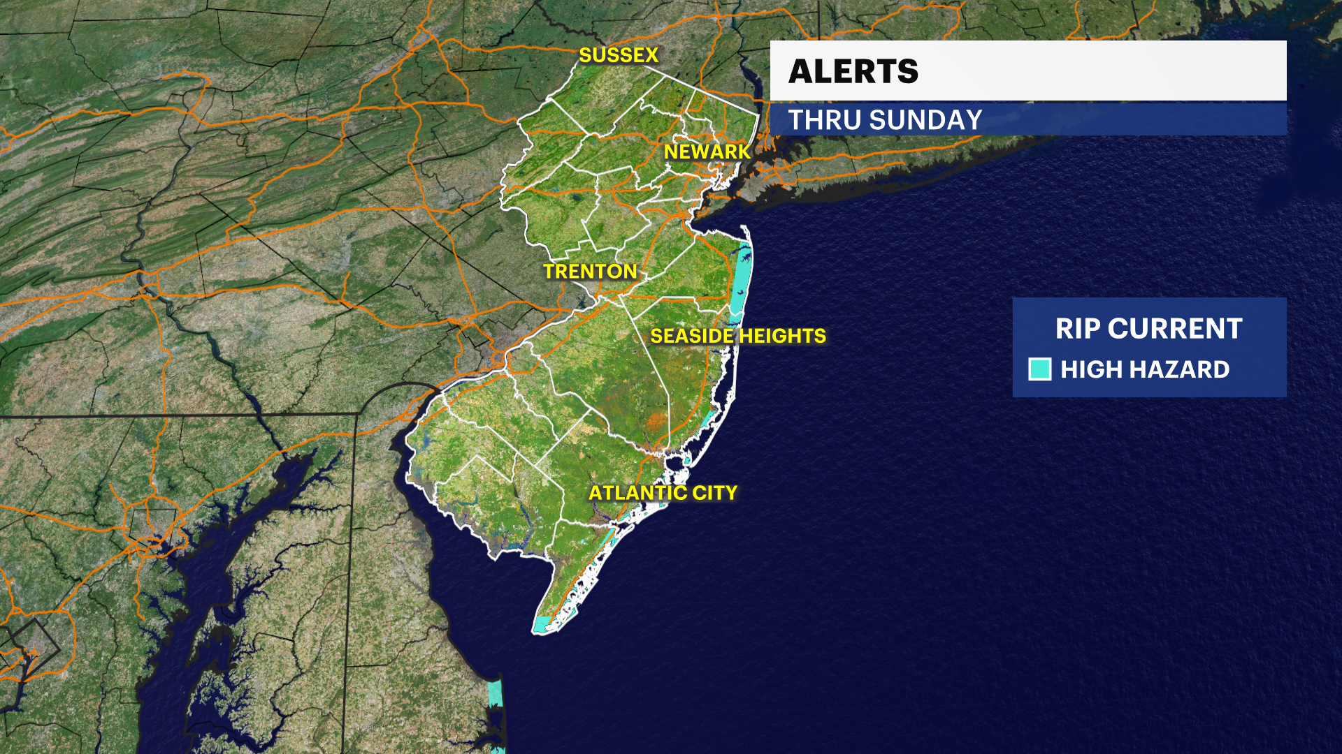
SUNDAY: Additional periods of lighter rain linger throughout the day Sunday. A high surf advisory is in effect until 6 p.m. There is a high risk of rip currents at the shore. Daytime highs in the upper-50s and low-60s.
MONDAY: Mostly cloudy skies. Daytime highs in the low-60s. Overnight lows around 48.
COMING UP: The upcoming week looks to be mostly dry, with more sun returning by the end of the week.
More from News 12
1:50

Family of man killed while riding scooter in Elizabeth says they ‘want justice’
2:30
Chilly morning, pleasant afternoon Sunday in New Jersey
0:33

Officials: 2 dogs killed, FedEx truck destroyed in separate South Brunswick fires
0:15

Authorities probe alleged social media threat made by Paramus High School student
0:13

Police: Green Brook man wanted for questioning in Newark shooting incident
2:16
