STORM WATCH: Tracking potential for storms Friday afternoon
Storm Watch Team Meteorologist Dave Curren says that winds could get as high as 50 mph, with torrential downpours.
More Stories


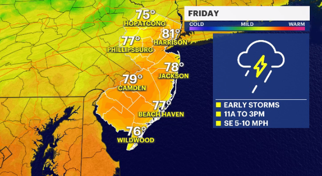
New Jersey has the potential to see stormy weather late Friday morning through the afternoon.
Storm Watch Team Meteorologist Dave Curren says that winds could get as high as 50 mph, with torrential downpours.
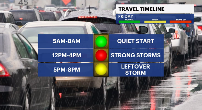
FRIDAY: Partly cloudy for the morning, followed by the potential for stormy weather by late morning. Curren says these storms could last until around 4 p.m. Thunder, lightning and hail are likely. Daytime highs around 82 degrees. Overnight lows around 65.
MORE: News 12 New Jersey Weather Center
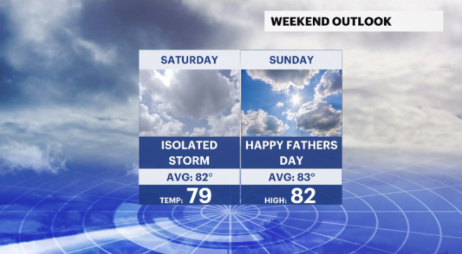
SATURDAY: Mostly cloudy. Chance for isolated and widely scattered storms in the northeastern part of the state. Daytime highs around 79 degrees. Overnight lows around 64.
SUNDAY: Mix of sun and clouds for Father’s Day. Daytime highs around 82 degrees. Overnight lows around 62.
MONDAY: Mostly cloudy but dry. Daytime highs around 81. Overnight lows around 65.
COMING UP: Mostly cloudy for the upcoming week. Temperatures in the mid-70s. Another chance of storms for the upcoming Saturday.