

Today’s Tides
Loading date...| Time | Tide | Height |
|---|---|---|
| Loading tides... | ||
Tomorrow’s Tides
Loading date...| Time | Tide | Height |
|---|---|---|
| Loading tides... | ||
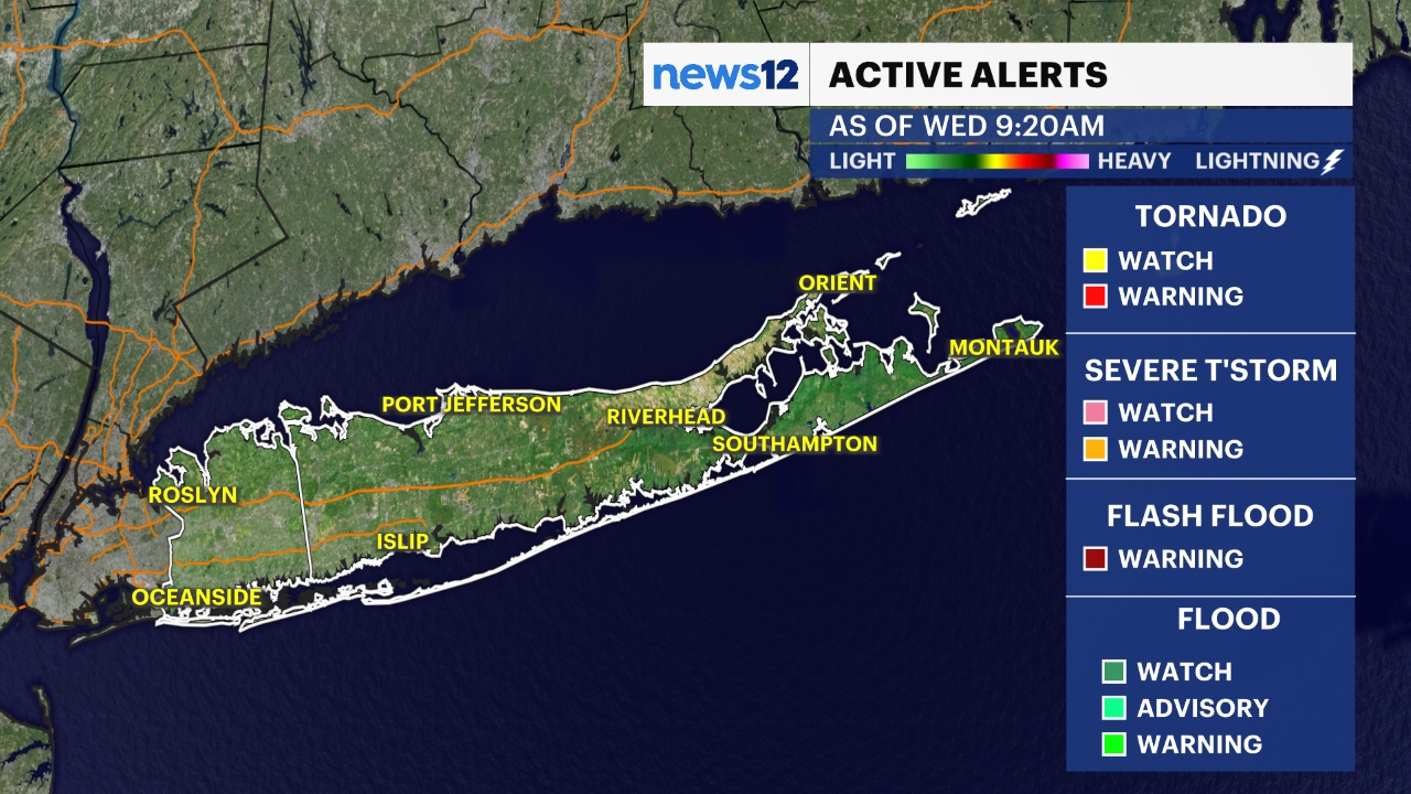
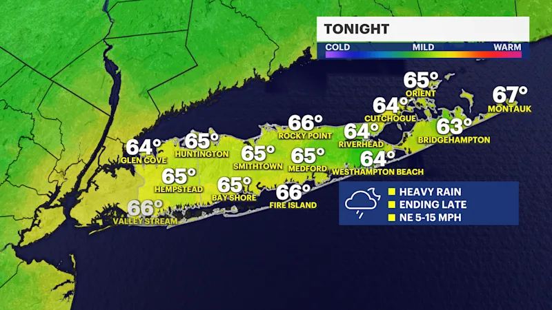
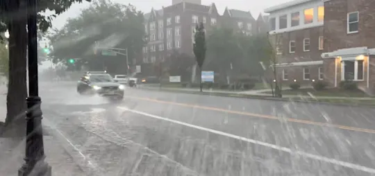
After a nice start to the day, the weather will be rough through this evening. Scattered areas of rain showers are leading to heavy, torrential downpours and a chance of thunderstorms through the first half of tonight. Travel is dangerous at times due to low visibility from downpours and areas of flooding. Always turn around if you notice an area covered by water since it is difficult to tell how deep it is, especially after dark.
The worst rain will begin to wind down after 8 p.m. from west to east. That said, scattered rain and a few downpours will remain possible overnight and into early Friday morning, mainly across eastern Suffolk County.

Here is a look at the latest future radar for Long Island showing the timing of the moderate-to-heavy rain impacting Long Island into early tomorrow.
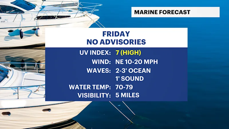
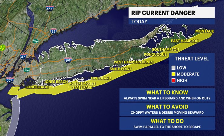
Boating and heading to the beach will be dangerous this evening with heavy rain and a few thunderstorms around. Please avoid these activities tonight. Anyone heading to the beach anytime should check the latest rip current statements before getting in the water. Check out more of the local beach weather forecast and tides here.
TONIGHT: STORM WATCH -- Flooding possible from periods of torrential rain. The worst rain will begin to taper off after 8 p.m. from west to east, but scattered downpours will linger over especially eastern Suffolk County overnight and into early Friday. Please use caution when traveling. Lows near the mid-60s.
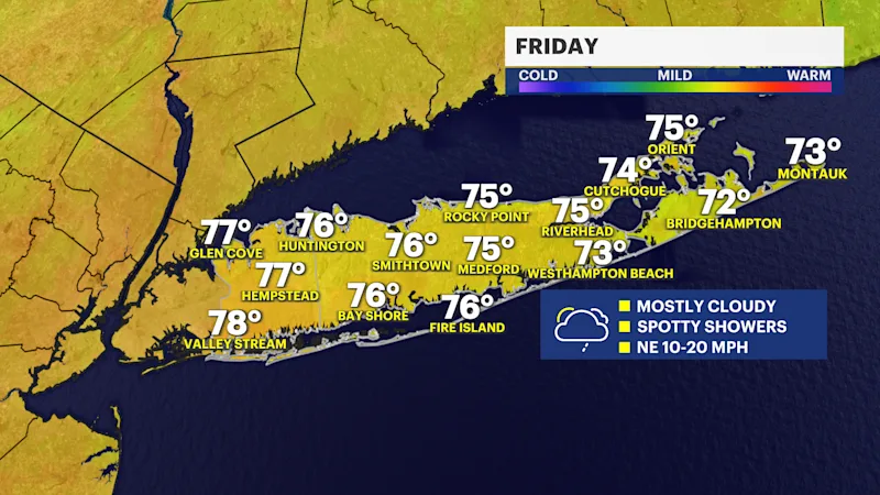
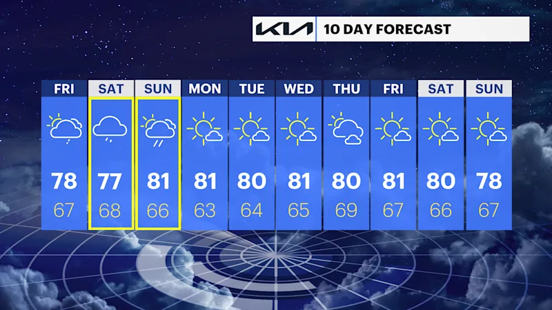
FRIDAY: Partly sunny to mostly cloudy with a chance for a few spotty showers. Highs around 78. Lows near 67.
SATURDAY: Mostly cloudy with periods of rain likely, tapering off into the evening and night. Highs around 77. Lows near 68.
SUNDAY: Clouds with a few breaks of sun. Scattered showers and a thunderstorm possible. The timing of any weekend wet weather will become clearer over the next couple of days. Highs around 81. Lows near 66.
MONDAY: Mostly sunny. Highs around 81 degrees. Lows near 63 degrees.
TUESDAY: Mostly sunny. Highs around 80 degrees. Lows near 64 degrees.
WEDNESDAY: Mainly sunny. Highs around 81 degrees. Lows near 65 degrees.
THURSDAY: Partly sunny. Highs around 80 degrees. Lows near 69 degrees.