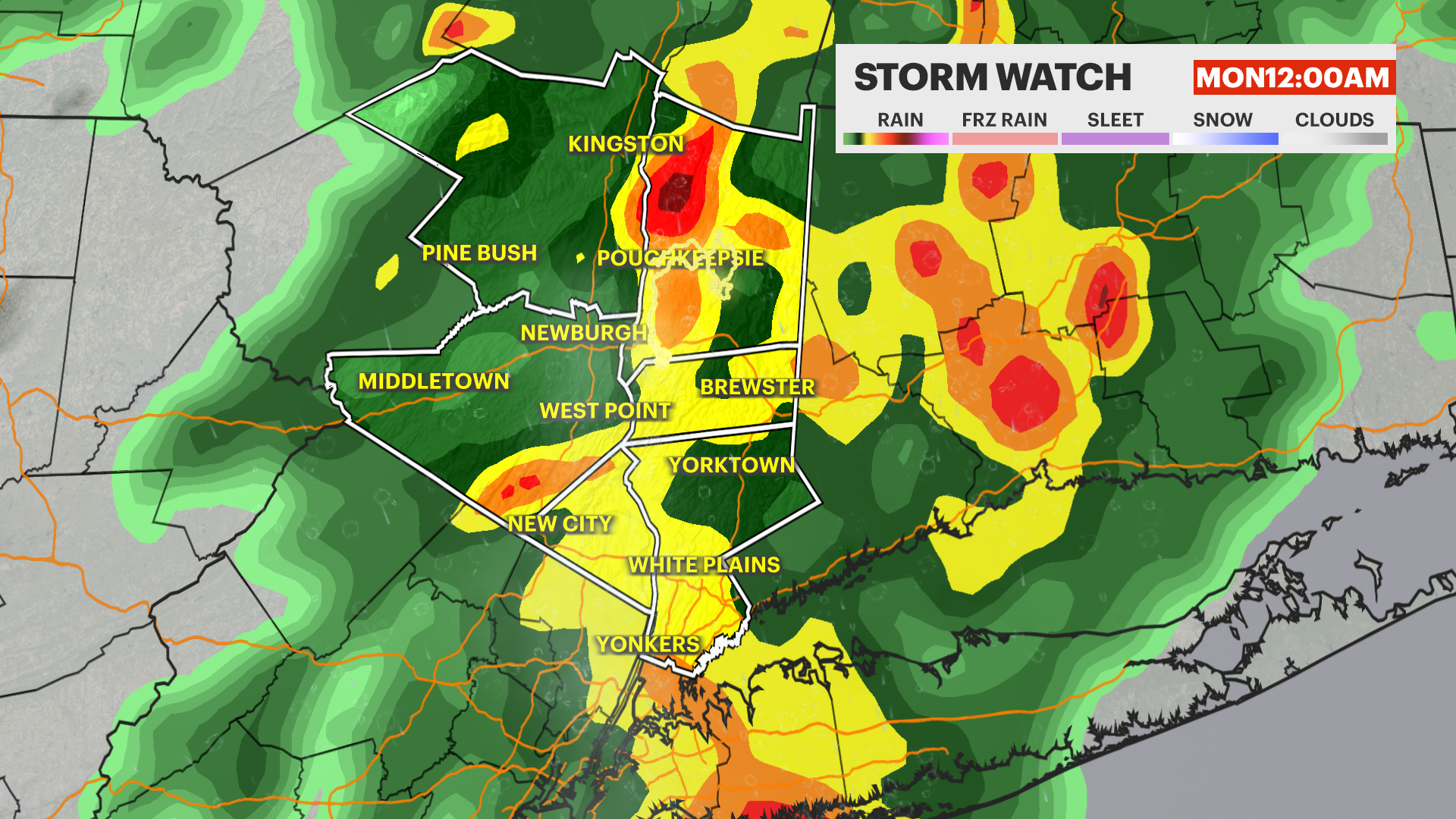
STORM WATCH: Storm risk increases across the Hudson Valley tonight after a hot summer-like day
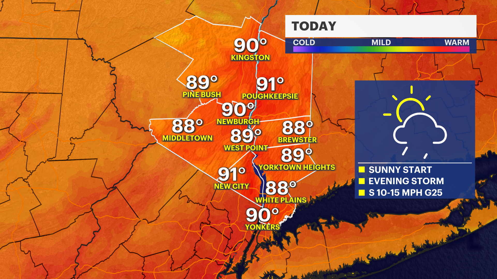
Temperatures soar near 90 degrees today before showers and thunderstorms move in tonight. Cooler, drier air returns Monday with a more comfortable week ahead.
More Stories


What to Expect
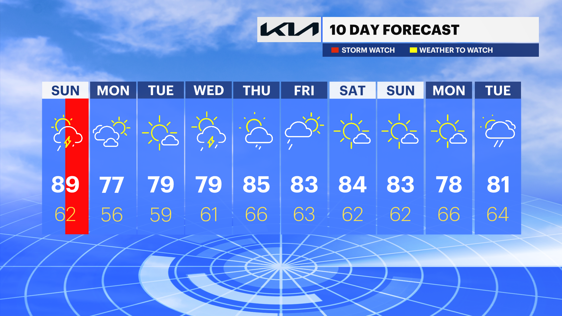
Summer-like warmth peaks today before a cold front sweeps through tonight with showers and thunderstorms. Some storms could produce heavy downpours, but the unsettled weather will be short-lived as cooler, drier air arrives to start the workweek.
The overall pattern remains fairly comfortable through much of the week, with temperatures hovering near seasonal levels and several opportunities for sunshine. While a few rounds of showers and thunderstorms are possible Wednesday through Friday, there are no signs of a prolonged washout, and next weekend is shaping up to be dry and pleasant.
Today: Increasing clouds, breezy conditions, and unseasonably warm temperatures with highs near 90 degrees. Showers and thunderstorms develop later.
Monday: Sunny, cooler, and less humid with highs in the mid to upper 70s.
Tuesday: Mostly sunny and pleasant with highs in the upper 70s.
Wednesday: Partly sunny with scattered showers and thunderstorms possible, especially during the afternoon. Highs in the upper 70s.
Thursday: A mix of sun and clouds with scattered showers possible. Warmer with highs in the mid to upper 80s.
Friday: Partly sunny with a chance for a passing shower. Highs in the low to mid-80s.
Saturday: Sunny and comfortable with highs in the low to mid-80s.