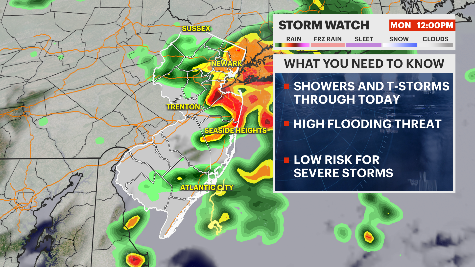
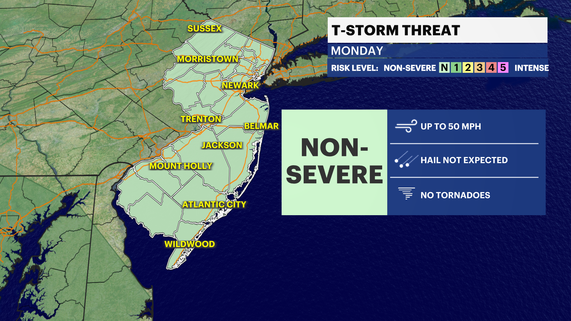
STORM WATCH: Heavy storms to bring a flash flood threat through the day
Rounds of heavy storms will dump several inches of rain locally today
More Stories


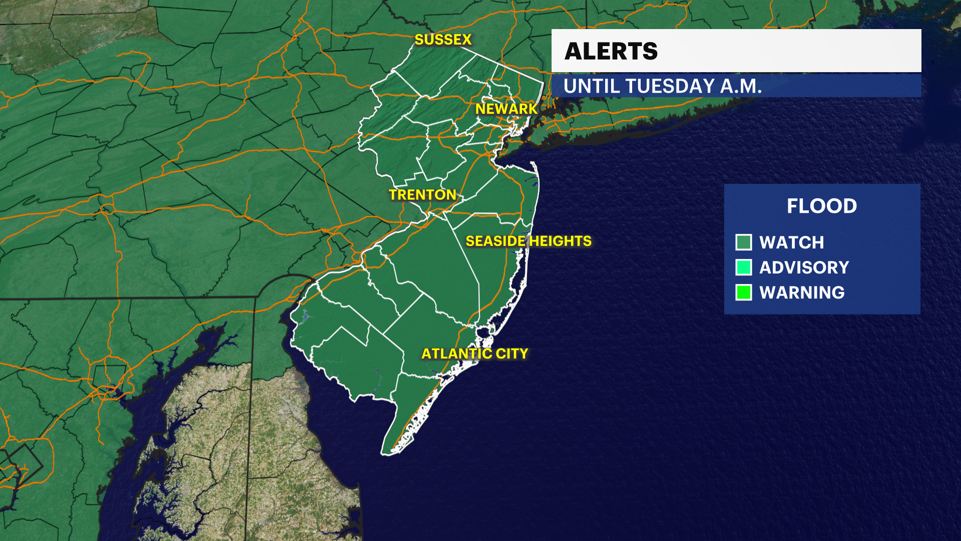
ALERTS: Flood Watch until Tuesday morning
FORECAST:
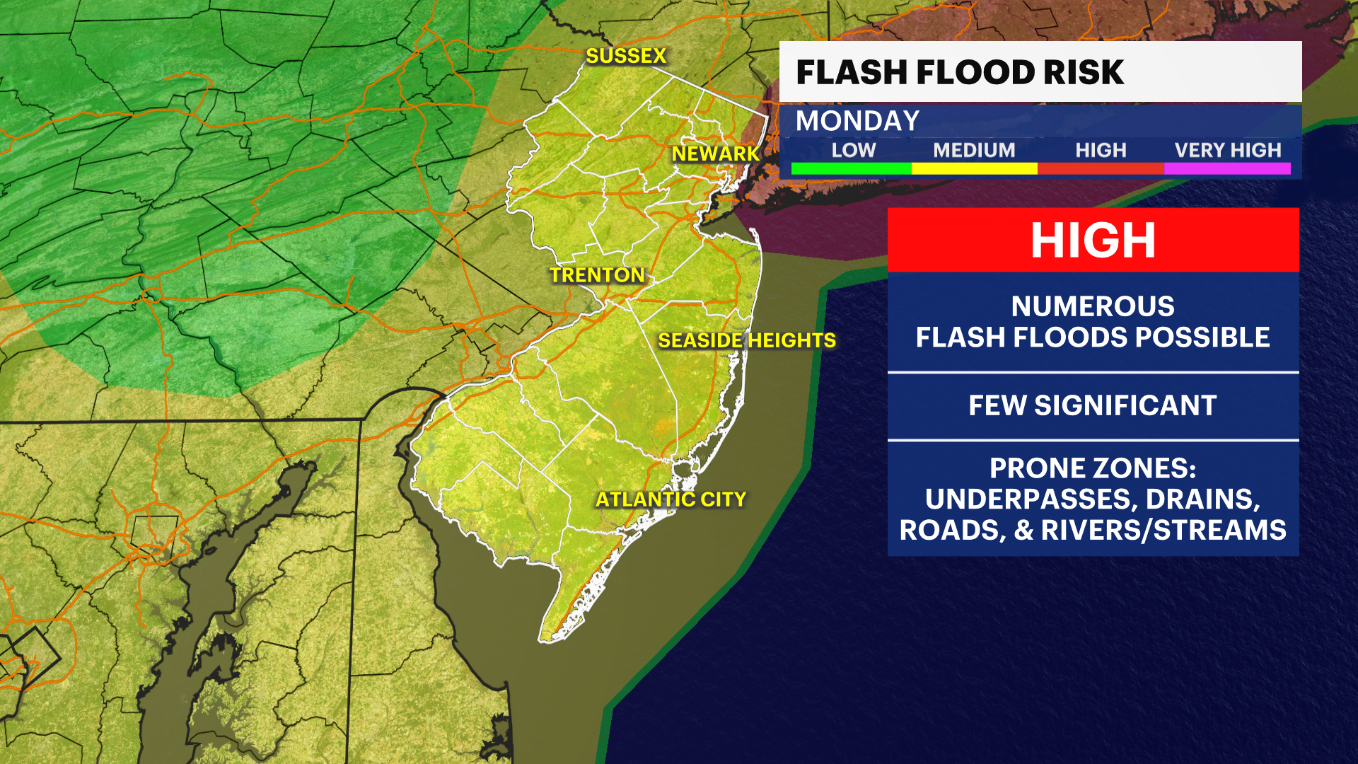
Rounds of heavy showers and thunderstorms developing statewide today. The biggest concern will be flash flooding with slow storms tracking over the same areas, leading to several inches of rain falling in a short period of time.
Urban locations, poor-drainage areas, and flood-prone roadways will be especially susceptible to flooding.
Remember: Turn Around, Don't Drown. Never attempt to drive through flooded roadways. Just a small amount of moving water can sweep away a vehicle and create a life-threatening situation.
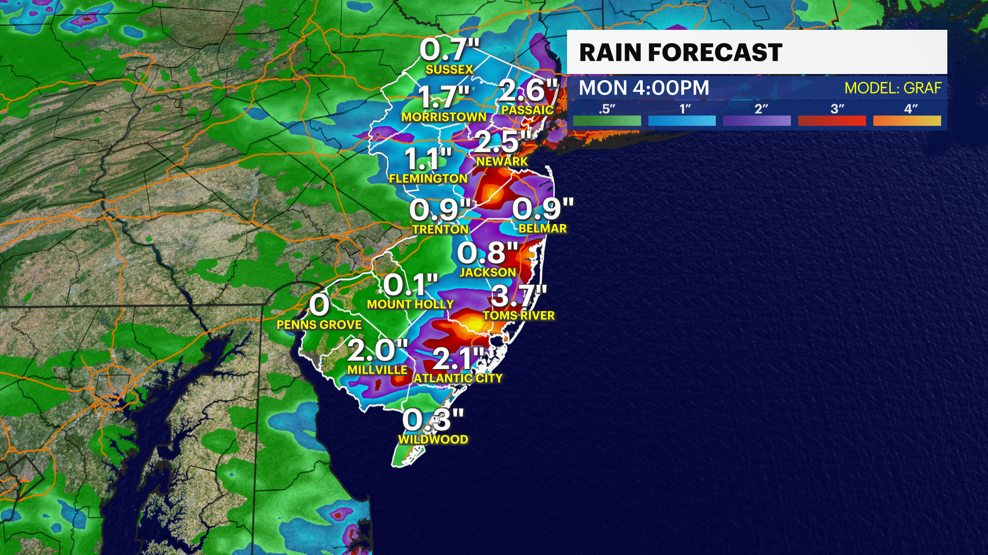
By the time this wet pattern winds down, most of New Jersey will pick up 1-3 " of rain, with isolated spots seeing even higher totals. There will be more chances for showers and storms through the week and into the first half of the weekend.
RELATED: PSE&G Power Outage Map
RELATED: JCP&L Power Outage Map