STORM WATCH: Lingering rain showers as snow exits New Jersey; tracking a midweek storm system
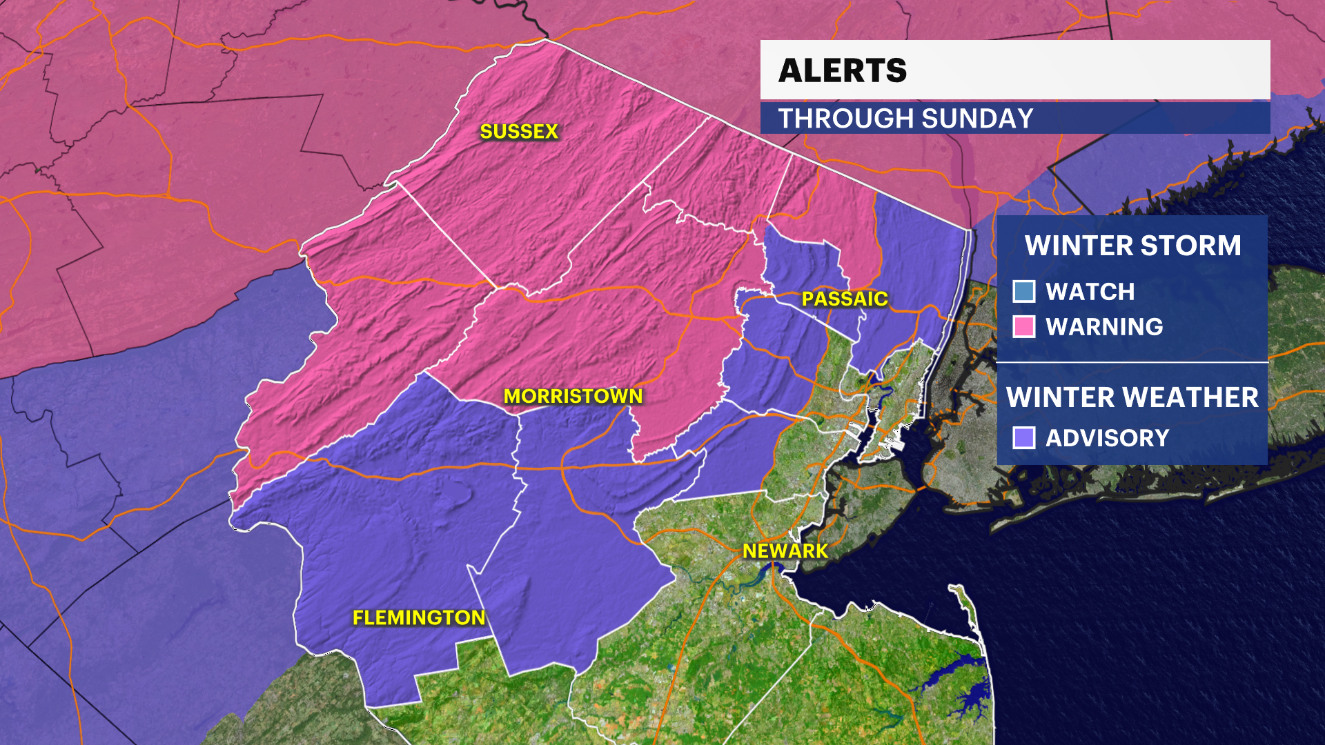
The News 12 Storm Watch Team is tracking this weekend winter storm as it moves across New Jersey into Sunday morning.
More Stories


WEATHER ALERTS: Winter storm warnings issued for Warren, Sussex, northern Passaic, Morris and northwestern Bergen counties until 6 p.m. Sunday. Winter weather advisories issued for Hunterdon, Somerset, southeastern Bergen, western Essex, western Union and southern Passaic counties through Sunday evening.
A coastal flood advisory is in effect for Ocean County until 8 a.m. Sunday.
MORE: News 12 New Jersey Weather Center
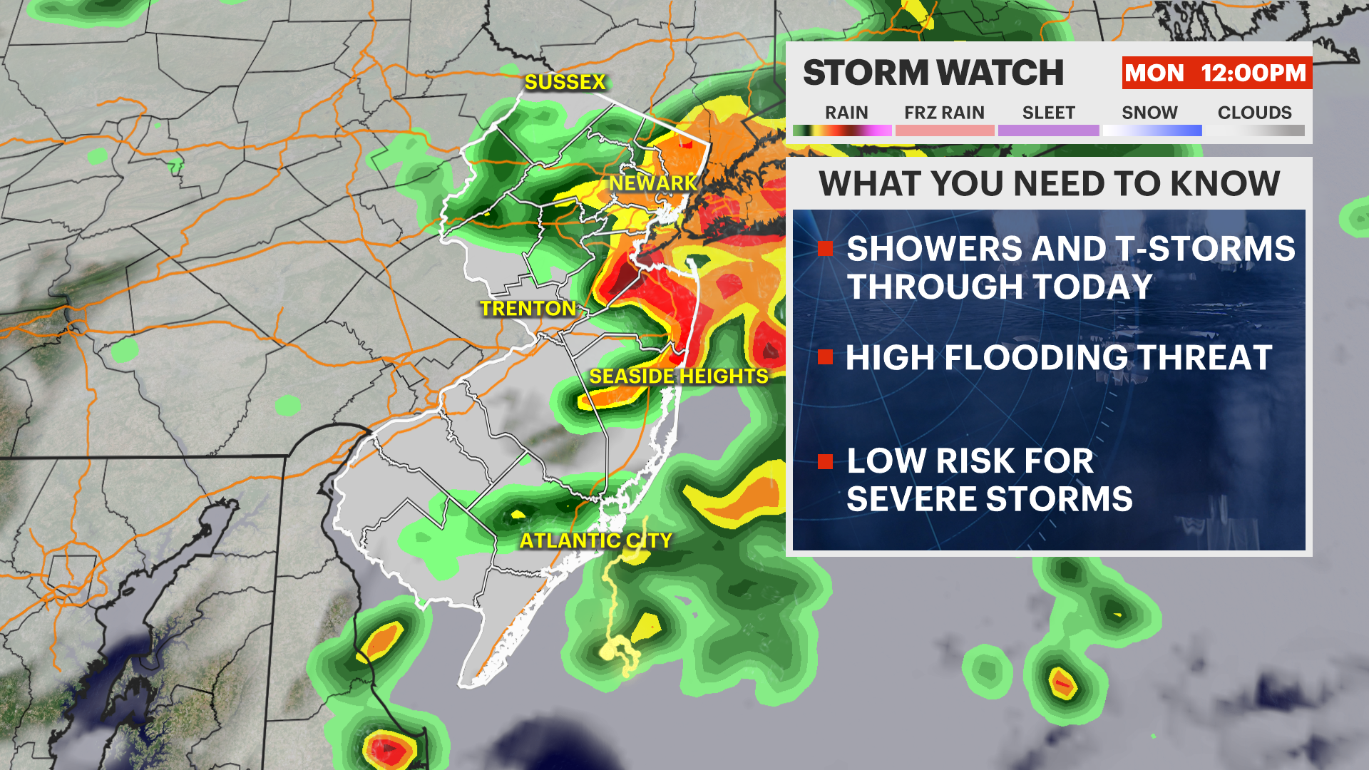
NEXT: The next weathermaker will bring a headache Tuesday into Wednesday. This will feature significant rain totals and widespread flooding. There is major concern over rivers, creeks and recently flooded communities to see the same again. This is especially true for areas near the Passaic, Raritan, and Millstone rivers.
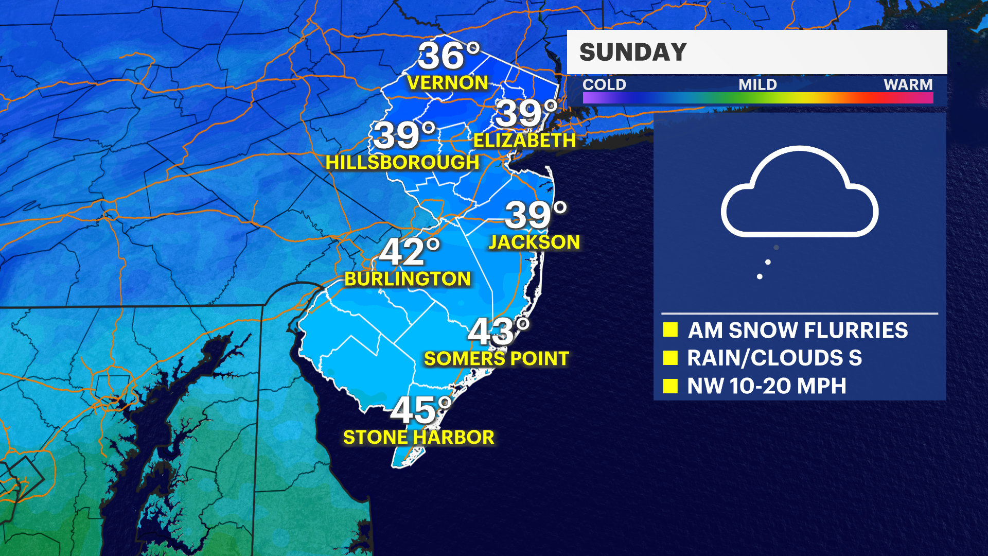
TODAY: Storm exited overnight, leaving south Jersey clear by sunrise. Chance of coastal flooding along Ocean County's beaches at high tide Sunday morning. Clouds linger with snow showers pushing across the state reaching down to Jackson through midday. In the afternoon, all precip ends as highs hover near 36-38 degrees. Road impacts are likely as heavy wet snow is slush and slicker. Overall messy afternoon and evening as temperatures drop overnight potentially causing black ice into Monday morning. Overnight lows near 29.
MONDAY: Quiet and thankfully dry. Highs near 43. Overnight lows near 28-30.
TUESDAY: Another round of significant rain and flooding across New Jersey beginning in the afternoon. This is poised to bring 1-2 inches of rain across flood-prone areas - Passaic, Saddle River, Hackensack, Boonton - This system sets up and stays until Wednesday. Highs near 41-46. Overnight lows near 28-31.