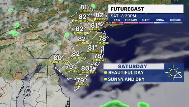
A weekend winner weather-wise with sunshine and comfortably warm temps
Plenty of sun. Favorable wind keeps humidity on hiatus. No rain for both Saturday and Sunday. I think we just hit the weather lottery.
More Stories


There really isn't too much weather to talk about heading into the weekend. Fair weather is slowly moving in from the Great Lakes. We are on the front side of said weather system. This ushers in more a northerly airmass that will influence the weather by keeping it drier (less humid), sunnier and also nice and warm despite temperatures being a touch below the seasonable norms.
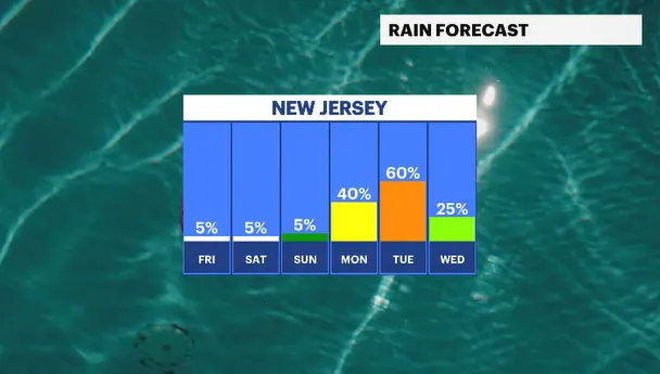
This weather pattern eases us into the weekend. Both Saturday and Sunday are rain-free. This will be the second weekend in a row we have not had rain for both days of the weekend. Maybe our luck has changed. The next opportunity for wet weather looks like late Monday into Tuesday. Tuesday looks to be the stormiest day we have next week. We will need to watch how that pans out over the coming days.