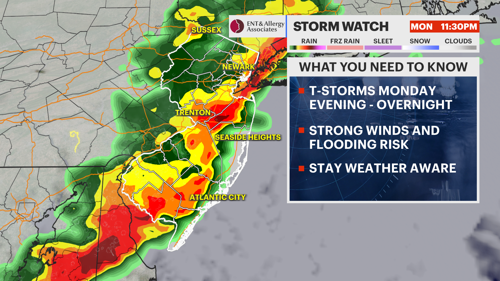
STORM WATCH: Rain and thunderstorm chances increase across New Jersey Monday
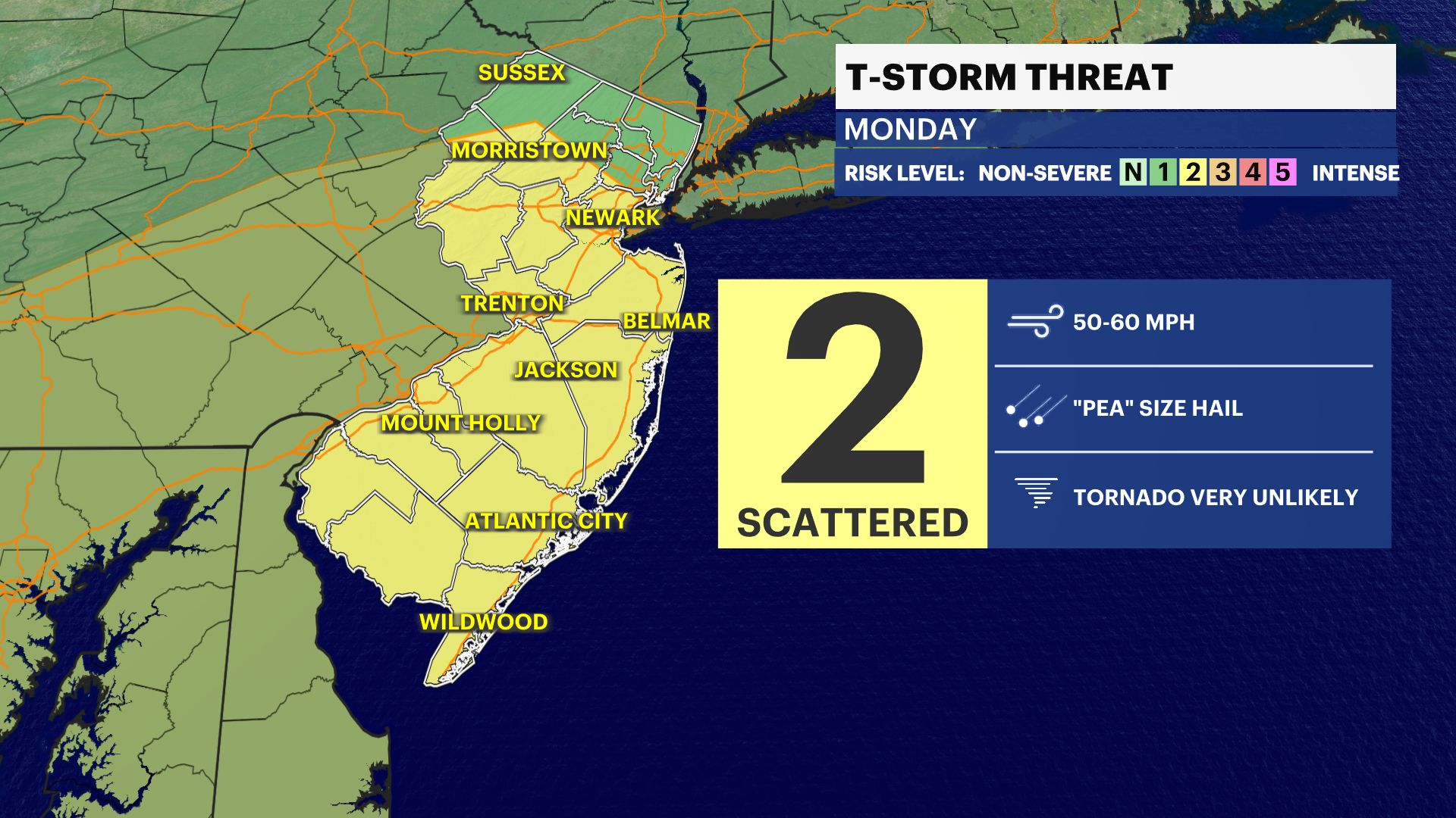
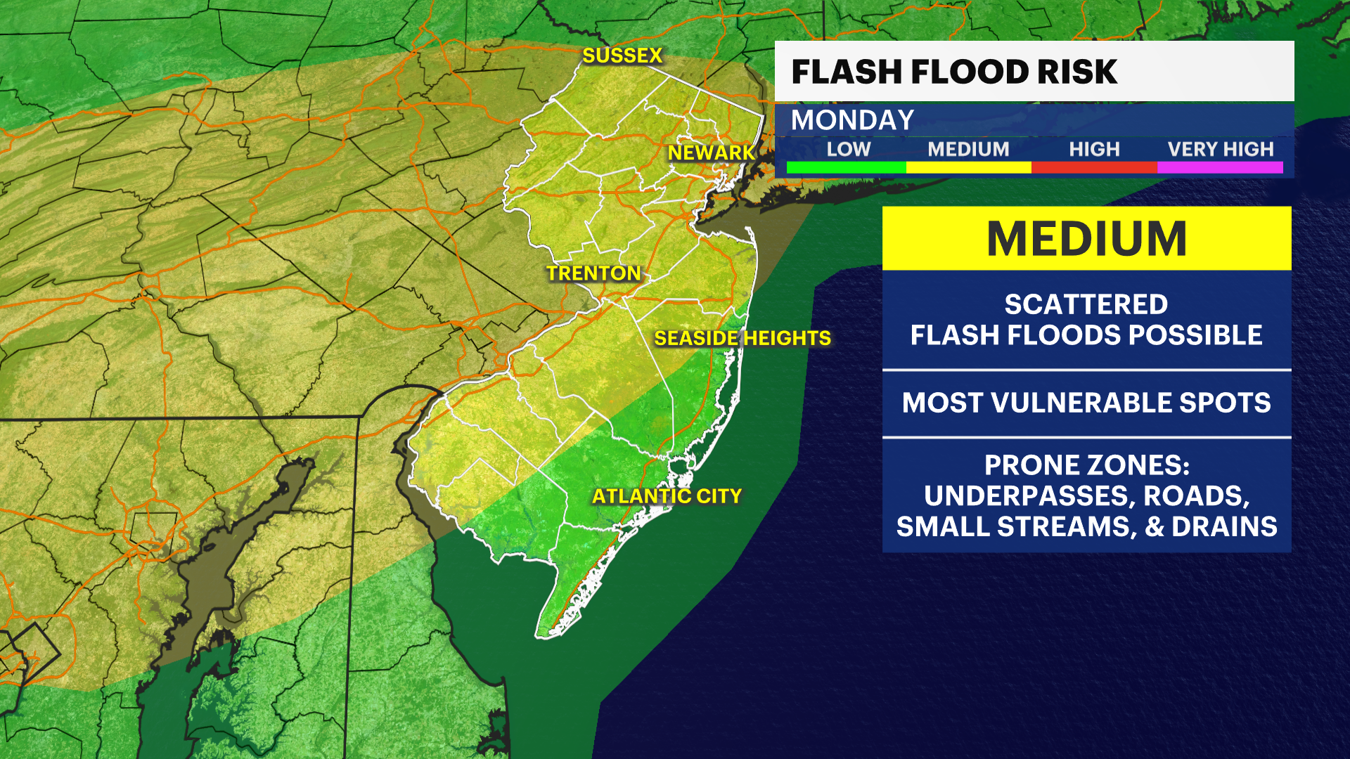
Showers and thunderstorms are expected to develop Monday afternoon and evening. Some storms could produce heavy downpours and gusty winds.
More Stories


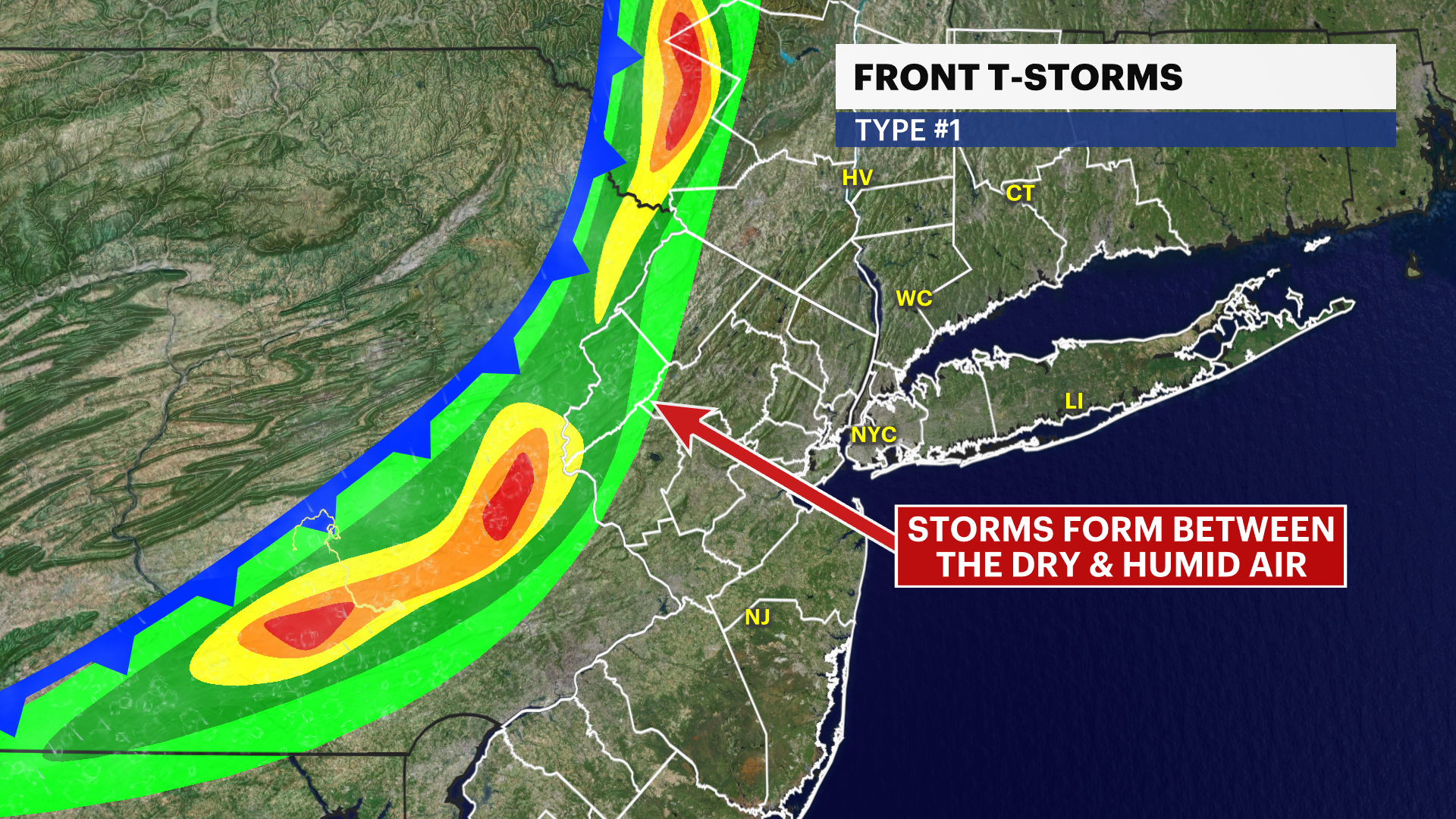

A wet and unsettled start to the week is expected, as a storm system moves into the region Monday. Clouds will increase through the morning before showers become more widespread during the afternoon.
Thunderstorms are also expected to develop, with the steadiest and heaviest rainfall arriving later in the day and continuing into the evening hours.
Some storms could produce locally heavy downpours, gusty winds and periods of reduced visibility. Rainfall totals of around a half-inch to over an inch are possible in some locations by the time the system exits.
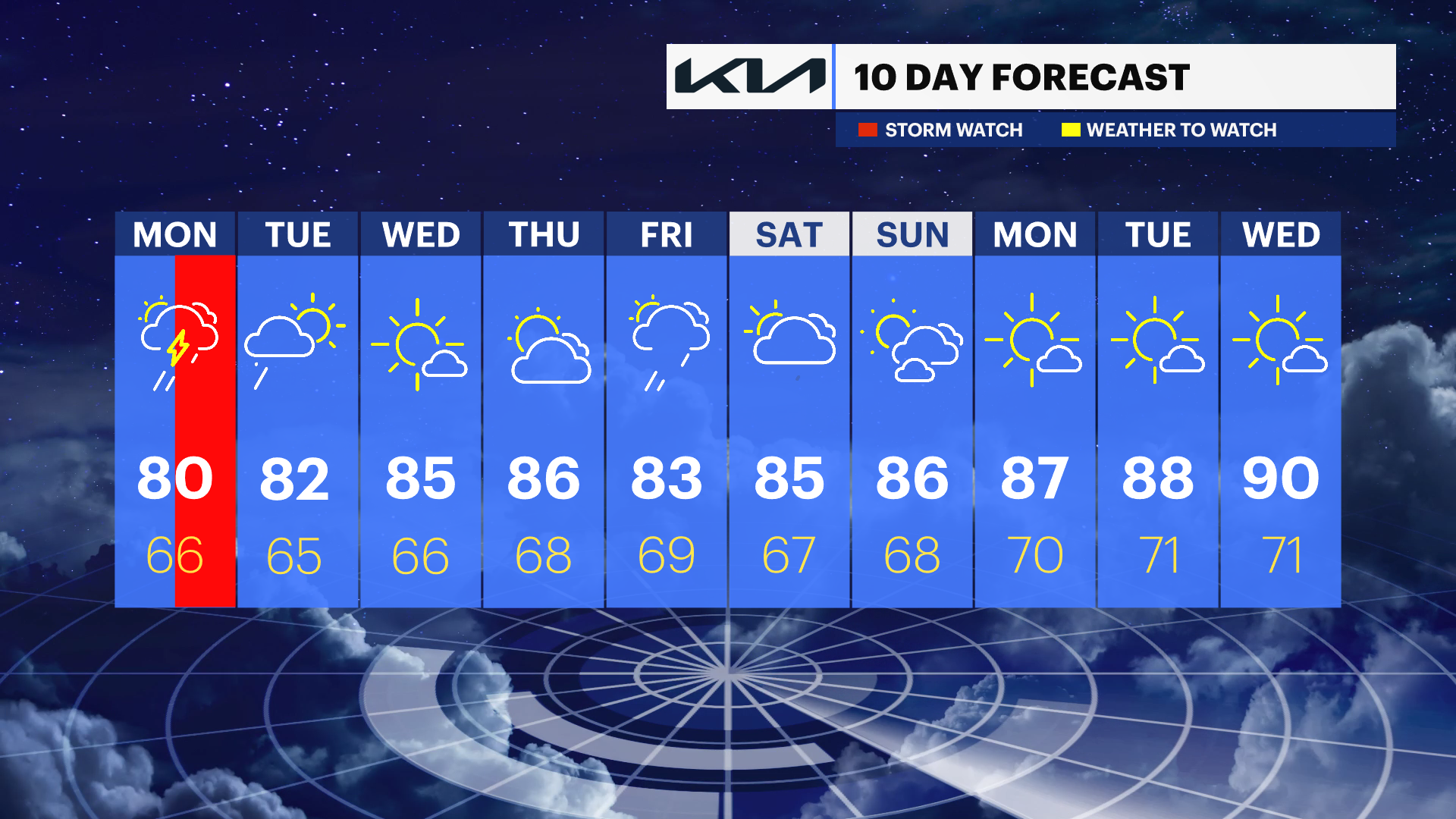
Conditions improve quickly by Tuesday as the storm system pulls away. Sunshine returns for the middle of the week, and temperatures gradually climb into the mid- and upper 80s before a summer-like weekend arrives.
Monday: Showers develop during the day, becoming widespread by afternoon with thunderstorms likely. Locally heavy rain and gusty winds are possible. Highs in the upper 70s to around 80 degrees.
Tuesday: A few lingering morning showers are possible, followed by increasing sunshine. Highs in the lower 80s.
Wednesday: Sunny and warm with highs in the mid-80s.
Thursday: Mostly sunny and seasonably warm with highs in the mid- to upper 80s.
Friday: Partly sunny with scattered showers and thunderstorms possible. Highs in the mid- to upper 80s.
Saturday: Mostly sunny with scattered showers possible. Highs in the mid- to upper 80s.
Sunday: Mostly sunny and very warm with highs in the mid- to upper 80s.