More Stories
WHAT YOU NEED TO KNOW
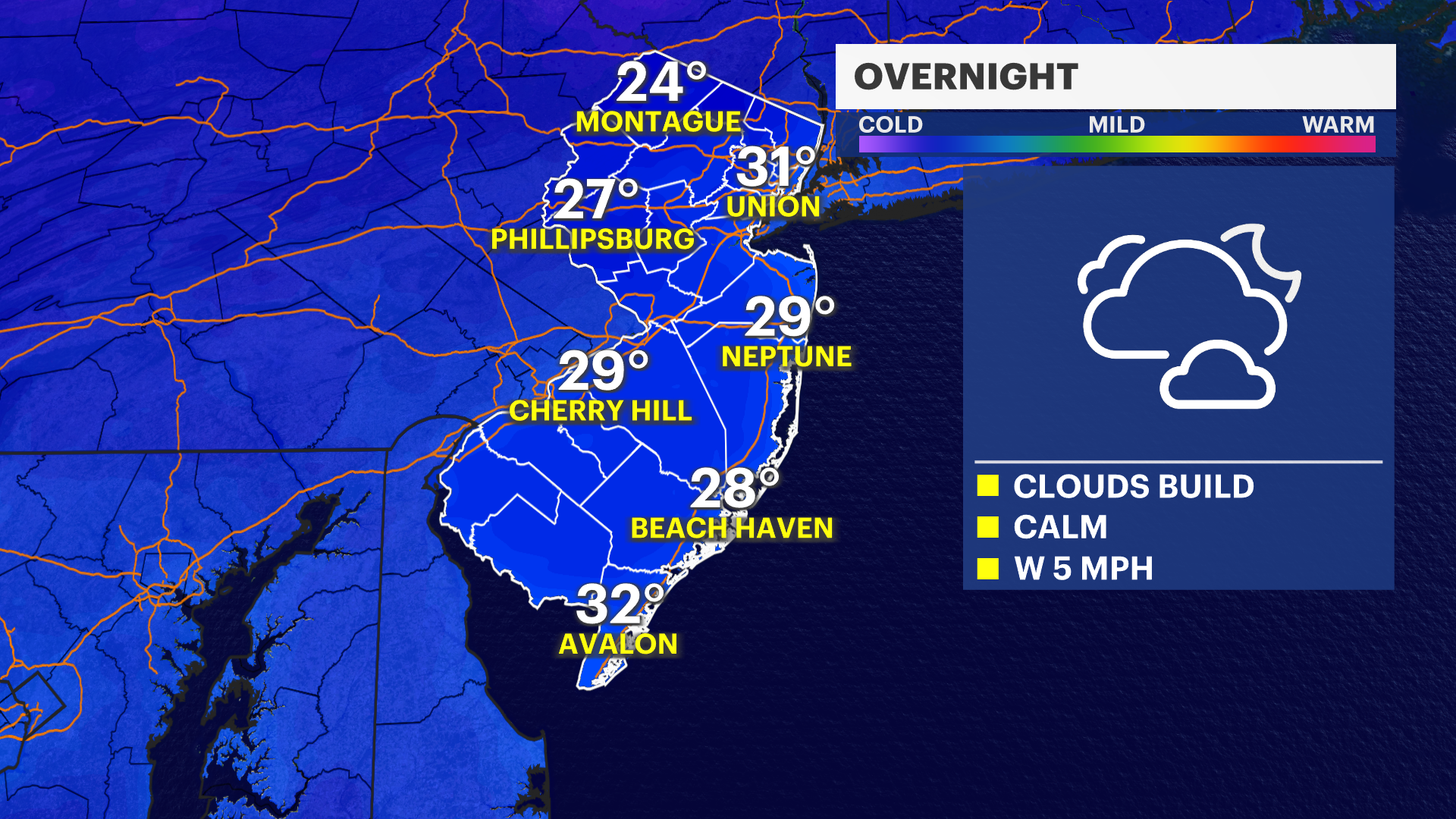
Clouds continue to build for the evening and into the overnight. It will be calm and quiet for the overnight, but cold. Temperatures will be dropping into the 20s and low-30s. Monday temperatures soar into the 50s and high temperatures stay in the 50s through Thursday. Then there will be a steady cool off into the weekend. Low temperatures continue to get less harsh. By Tuesday night, there will see more widespread lows above freezing temperatutes that will stay there for a few days. Temperatures will be well above average for the first half of the week. The end of the week will feature some cold air from Canada returning New Jersey to more seasonable temperatures.
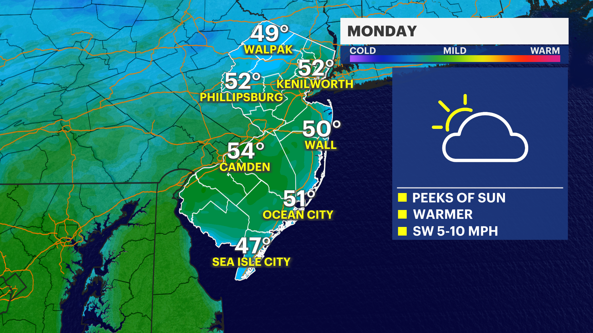
Beyond the already-mild temperatures. There will be less winds for a while. This will allow temperatures to feel mild.
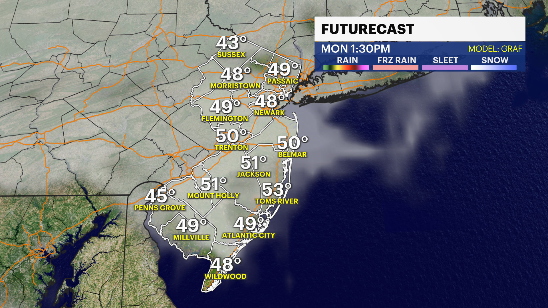
As far as rain, New Jersey remains dry throughout the rest of the weekend and into Monday. A brief period of light sprinkles is possible for Tuesday for parts of Northern New Jersey. It will be very minor. Plenty will have a completely dry Tuesday. Wednesday is dry as well with the next opportunity for showers moving through during Thursday. Depending on exact timing and speed, this could linger into earliest parts of Friday.


More from News 12
2:07

Who is ready for spring? Temperatures are warming heading into the weekend

25 tips to keep you safe during a winter storm
4:12

What you need to know about the snowstorm heading toward the tri-state Sunday into Monday
1:37

Warmer temps finally on the way after brutal stretch

Back-to-back storms? There’s weather to watch this weekend in the tri-state
1:39
