STORM WATCH: Linger showers and storms could aggravate flooding problems
The worst of the rain is over. The flood waters will slowly recede. When are we going to see the sun again?
More Stories


ALERTS: Flood Watch until Tuesday morning
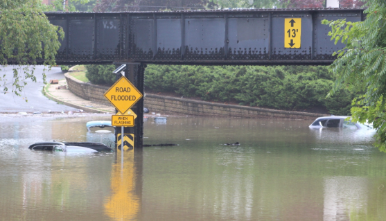
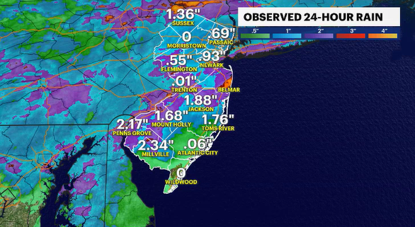
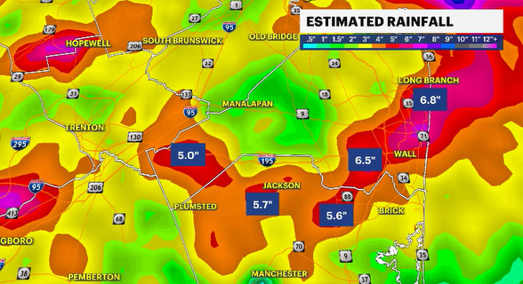
Parts of New Jersey have collected between 1 and 3 inches of rain in the last 24 hours. In some neighborhoods, a solid month’s worth of rain has collected in just over the last three days, obviously leading us to the point where we are right now with water-covered, impassable roads. While there are still some showers and storms to track tonight, the worst seems to be over for now.
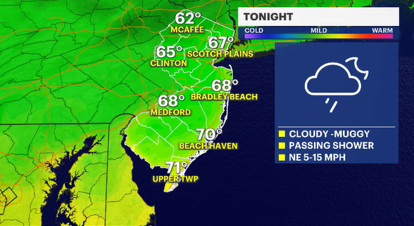
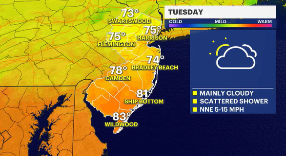
It will still be warm and humid tonight. In this still unsettled weather environment, showers could pop up at any given moment, but overall, you can expect primarily just overcast conditions. The clouds will linger through most of the day tomorrow. Temperatures, as a result of the cloud coverage and the winds from the north-northeast off the ocean, will be much cooler than expected for early July, where the normal daytime temp would be 87 degrees. New Jersey should be about 10 degrees cooler tomorrow.
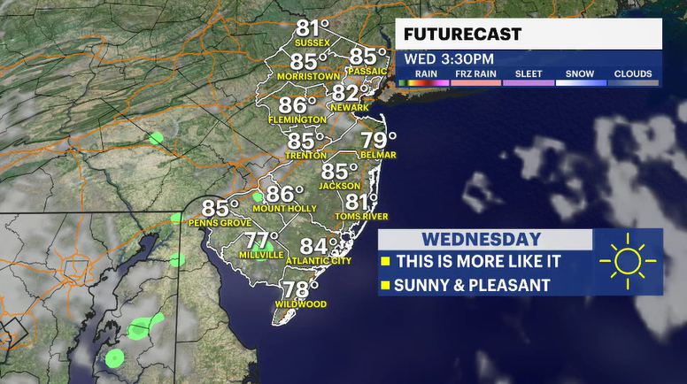
The sun will eventually show up on Wednesday. The middle of the week looks wonderful. It will be mainly sunny and seasonably warm. It does look like the humidity will be on the climb in the middle of the afternoon, but it's July in New Jersey. What do you expect?
The forecast becomes more unsettled and summer-like Thursday and Friday. Temperatures will be flirting with near 90 degrees. Early sunshine will create enough instability in the atmosphere to trigger afternoon and evening thunderstorms.


