STORM WATCH: Rounds of possibly destructive storms expected for Tuesday
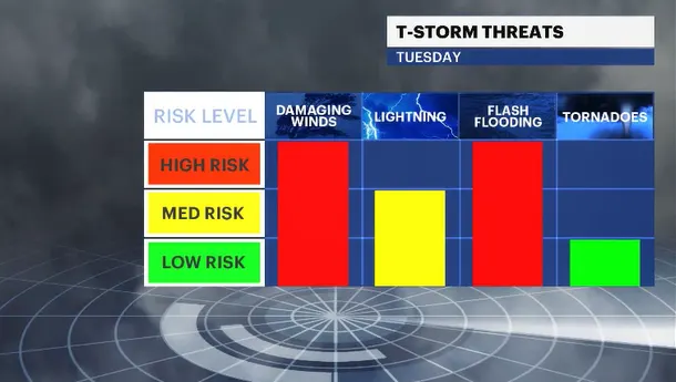
On-and-off storms are in the forecast once again on Tuesday. Flash flooding and dangerous winds are expected. While the chances are low, the atmospheric conditions could produce a tornado or two. Be safe. Be smart. Any and all storm warnings should be taken very seriously.
More Stories


I'm just going to say it: Today was near-perfect summer weather. Wonderful sunshine. Not humid at all, and despite temperatures being in the low 80s and about six to seven degrees cooler than normal, who is complaining about low 80s any day of the year? I hope you enjoyed it.
There is another serious bout of weather we have to deal with both tomorrow and early Wednesday.
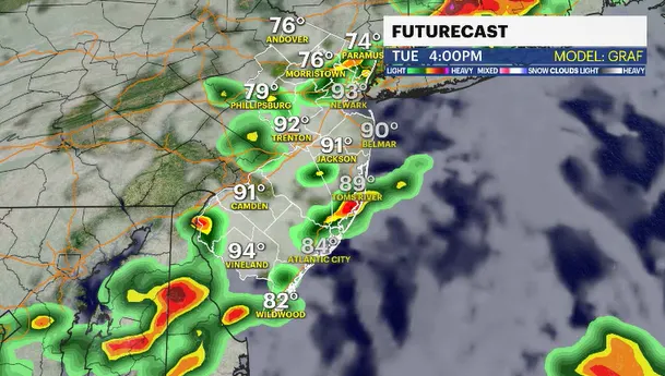
Rounds of thunderstorms are expected for most of the day tomorrow. Basically, the storms come at us in waves. A lot of rain will lead to flooding. Prolific lightning and large hail are also possible.
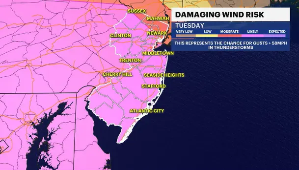
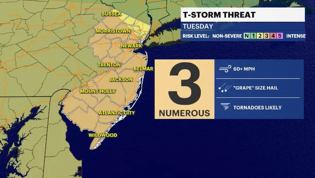
There is a very good chance some of the stronger thunderstorm cells that develop will draw down on that mid-level wind field a few thousand feet overhead and crash that down to the surface. Destructive winds over 70 mph could be possible. There is also just enough - it's not a slam dunk -but just enough winds changing direction with height that a tornado or two could develop. That's round one. Round two hits us possibly a little harder.
Late Wednesday morning or midafternoon, a squall line of destructive winds will race across the state. The real problem is that we had storms on Saturday. We are expecting more storms tomorrow. The ground will be saturated. The tree's root system base has been compromised. The stress of Saturday's severe weather and the stress of tomorrow's storms could be the straw that breaks the camel's back. I'd expect to see more tree damage and power outages on Wednesday. Plan accordingly.