Spring is in the air this week in New Jersey
After a dry and windy weekend, pleasant temperatures will start the workweek.
Share:
More Stories


NOW: Breezy conditions will diminish overnight. Temperatures will fall into the 40s and bottom out in the 30s.
NEXT: Monday and Tuesday will be warm days with clear skies. Temperatures will peak in the 60-65-degree range for most places. Winds will be light. However, with low humidity and a dry ground, the wildfire risk will remain elevated.
How your week will feel after that depends on where you are. The coastal counties, as well as those north of I-78, will be in the 50s. Meanwhile, those outside of there will be in the 60s. This is because winds will come out of the northeast, pulling in cold ocean/Long Island Sound air to those nearby.
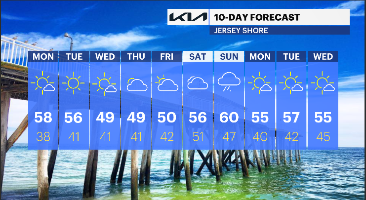
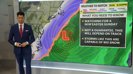
The weekend will see a much-needed rain maker. This will likely be on Sunday.