Sunshine and comfortable weather for New Jersey on Monday before rain returns
Plenty of sunshine, lower humidity and seasonable temperatures make for a summer day on Monday.
More Stories


WHAT TO KNOW
Expect a comfortable and clear overnight ahead. Some areas will be cool with temperatures dipping into the upper 40s.
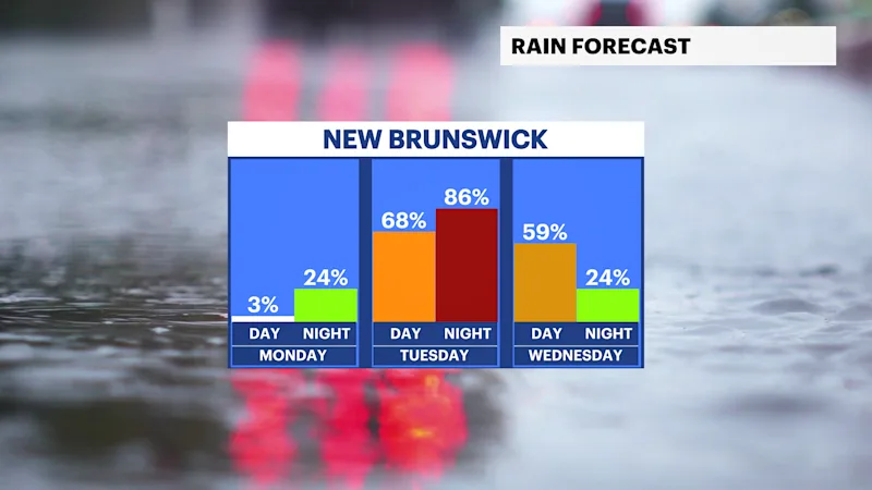
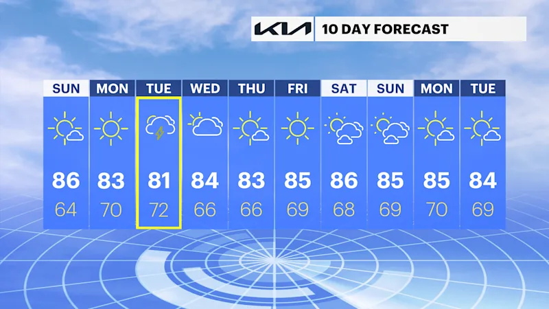
Monday stays dry, with more sunshine before the next storm system arrives Tuesday. Showers and thunderstorms become likely Tuesday afternoon and continue into Wednesday, bringing periods of heavy rain, gusty winds and lightning. Sunshine returns late in the week with warm, pleasant weather heading into next weekend.
Monday: Sunny, with pleasant summer weather. Temperatures in the low to mid-80s.
Tuesday: Increasing clouds, with showers and thunderstorms developing during the afternoon. Temperatures in the low 80s.
Wednesday: Mostly cloudy, with showers and scattered thunderstorms. Temperatures in the low to mid-80s.
Thursday: Mostly sunny and pleasant. Temperatures in the low to mid-80s.
Friday: Sunny and warm. Temperatures in the mid-80s.
Saturday: Mostly sunny and warmer. Temperatures in the upper 80s.