Sunny skies continue across New Jersey this weekend
Sunshine and comfortable temperatures will stick around through the weekend.
More Stories


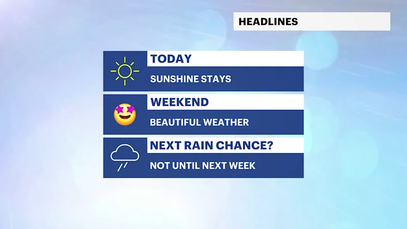
A beautiful stretch of summer weather continues today with plenty of sunshine, comfortable humidity and seasonable temperatures. Dry conditions will persist through the weekend, making it a great time to head outdoors.
The weather pattern turns a bit more active early next week. While Monday stays mostly dry, a few afternoon showers are possible. Better chances for showers and thunderstorms arrive Tuesday and linger into Wednesday before drier weather returns Thursday.
Today: Sunny and pleasant. Highs in the low to mid-80s.
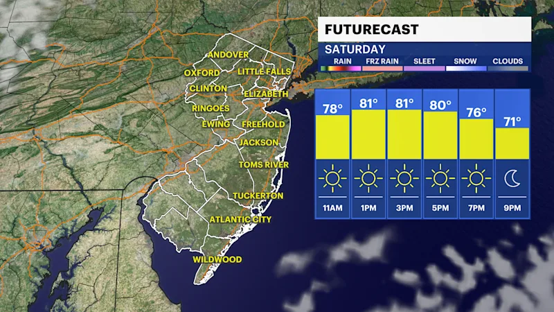
Saturday: Mostly sunny with comfortable humidity. Highs in the low to mid-80s.
Sunday: Mostly sunny and warm. Highs in the low to mid-80s.
Monday: Mostly sunny with a slight chance of an afternoon shower. Highs in the mid to upper 80s.
Tuesday: Mostly cloudy with showers and thunderstorms becoming likely during the afternoon. Highs in the upper 80s.
Wednesday: Partly sunny with scattered showers and thunderstorms. Highs in the mid-80s.
Thursday: Mostly sunny and warm. Highs in the mid-80s.