Dave’s Forecast: Cold temps overnight with slight warmup on the way; tracking weekend snow
Temperatures will be dropping quickly into the 20s and teens.
More Stories


Dress appropriately tonight - or don't - I’m not your dad. It's as cold as your ex's heart this evening.
OVERNIGHT: Temperatures will be dropping quickly. Daily highs this afternoon barely made it to 40 - a touch below the average. It was the 12th time this winter that temperatures at Newark Liberty International Airport failed to crack 40 for a high.
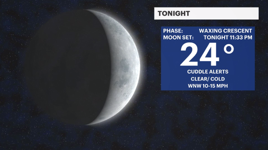
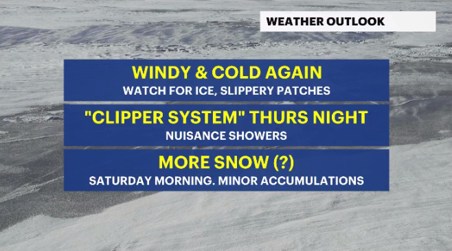
As temperatures drop again to the teens and 20s tonight, watch for a re-freeze of melted snow. Sidewalks, driveways, parking lots and front steps are the more susceptible areas prone to icy patches.
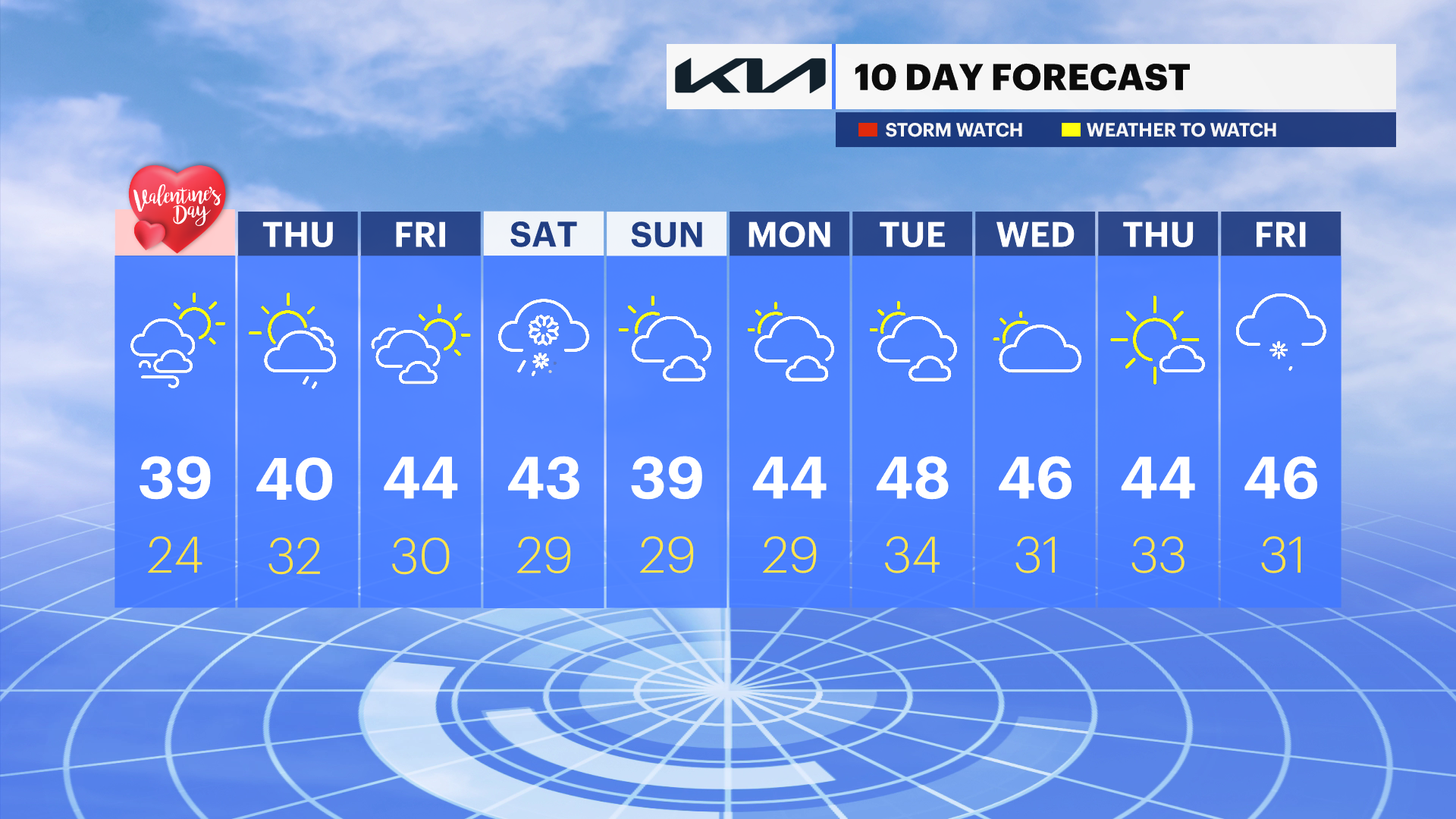
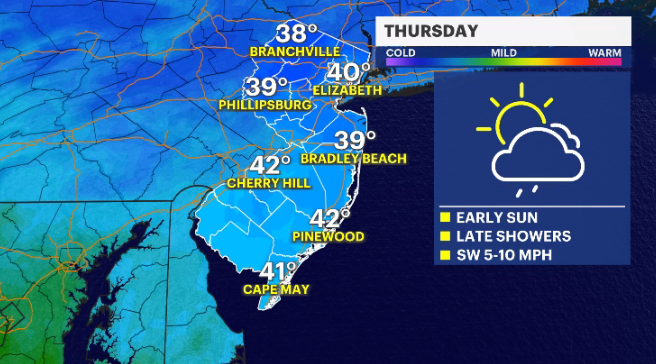
THURSDAY: The weather starts off full of sunshine tomorrow. Temperatures will slowly recover back to seasonable levels (low-40s). Some clouds will begin to collect in our New Jersey skies by the end of the day. A fast-moving "clipper" system drops down from Canada Thursday evening with sprinkles or flurries. A harmless weather feature that poses no problem, nor will it deliver any accumulations.
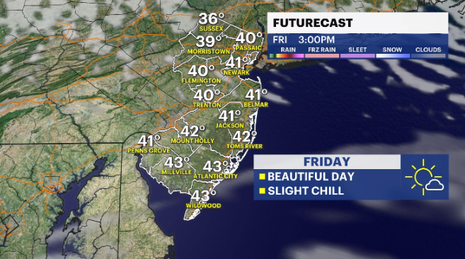
FRIDAY: A mix of sun and clouds with daytime highs around 44 degrees.
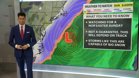
WEEKEND: Saturday will be the next opportunity for accumulating snow. This won’t be the type of storm we had on Tuesday, but 1 to 3 inches could be possible as the storm undercuts the area on Saturday afternoon.
Sunday looks to be mostly cloudy with temperatures barely reaching 40.