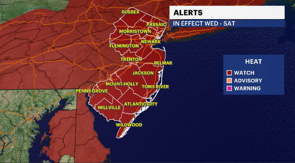
HEAT ALERT: Extreme heat set to grip New Jersey through the Fourth of July weekend
It has been a little over a year since we have had to deal with such punishing heat and humidity for days on end. Yet here we are. How are you going to stay safe and cool?
More Stories


You know the words... sing it with me now. "I'm Mr. Green Christmas, I'm Mr. Sun. I'm Mr. Heat Blister, I'm Mr. 101. They call me Heat Miser. Whatever I touch starts to melt in my clutch. I'm too much!"
Well, the next few days will be diabolical around New Jersey. Please be more cautious outside. Drink water more than you think you need to. Stay in the shade as much as possible, or stay indoors in air conditioning. Being outside in the scorching sun is extremely dangerous. Tornadoes and hurricanes get all the headlines, but heat is the No. 1 weather-related killer per year. And this building heat dome is going to be wicked.
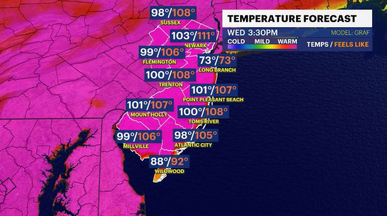
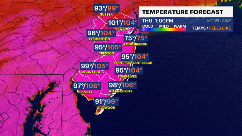
Fair weather that is over top of New Jersey right now will slowly slide off into the Atlantic. This will return a south-southwesterly wind that will transport this unusually hot atmosphere to the state. We could be looking at one maybe two record-breaking days when it comes to the heat. (Wednesday and Thursday) However, the triple-digit threat should continue into Friday and possibly Saturday.
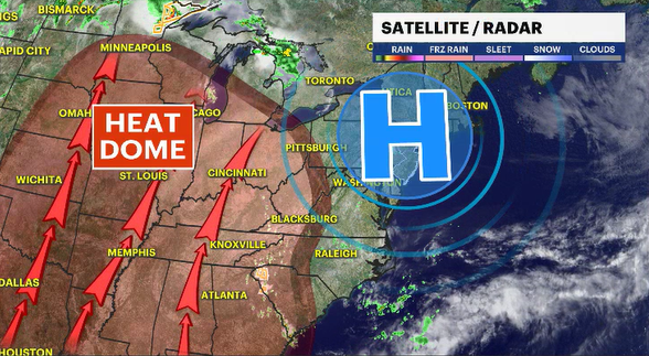
Heat is the center billing on the weather marquee, but because it is going to be so hot outside, there is a small threat for a few widely scattered, isolated thunderstorms to pop off. The best days for that to happen look to be Wednesday late afternoon and then again Saturday late afternoon.


