Dangerous heat set to grip Connecticut through the holiday weekend
Temperatures climb steadily through the week before a prolonged stretch of dangerous heat arrives Wednesday.
More Stories


WHAT TO KNOW
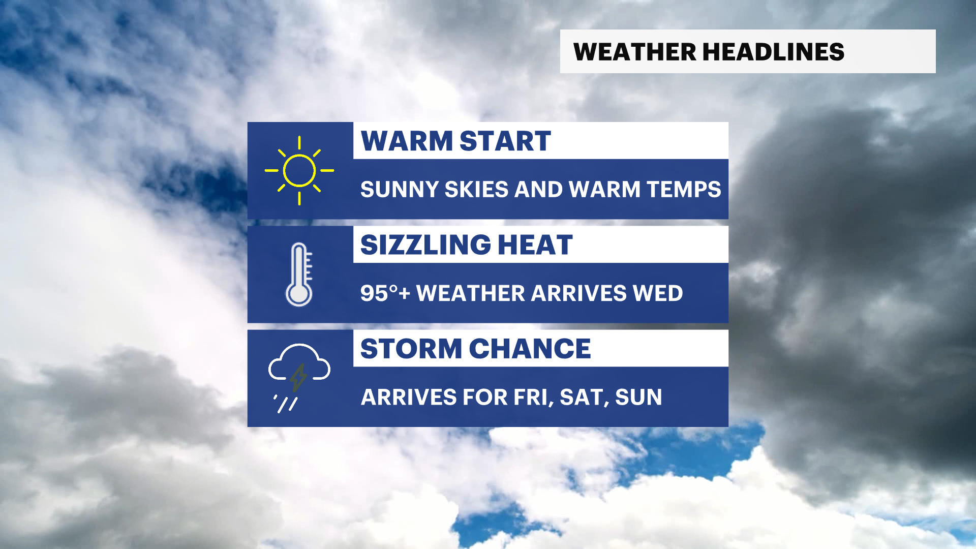
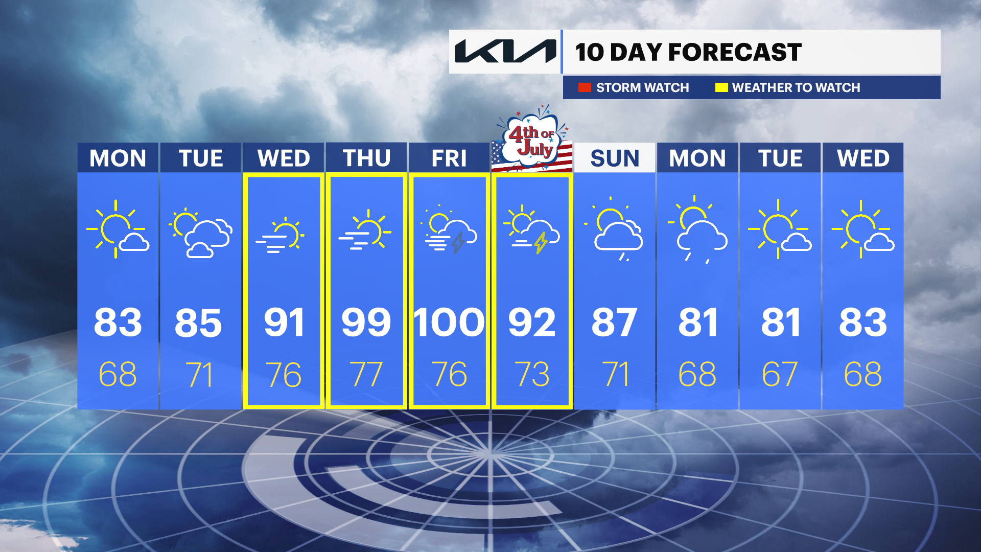
Heat and humidity will build steadily through the workweek as a strong ridge of high pressure settles over the region. Monday and Tuesday will be warm, but conditions become increasingly hotter by Wednesday as temperatures climb well above average.
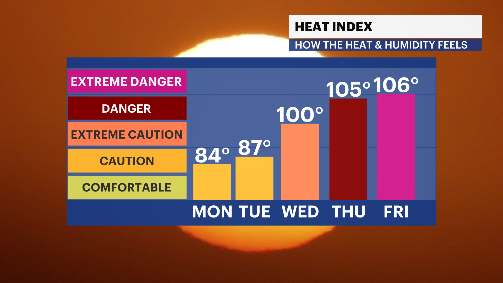
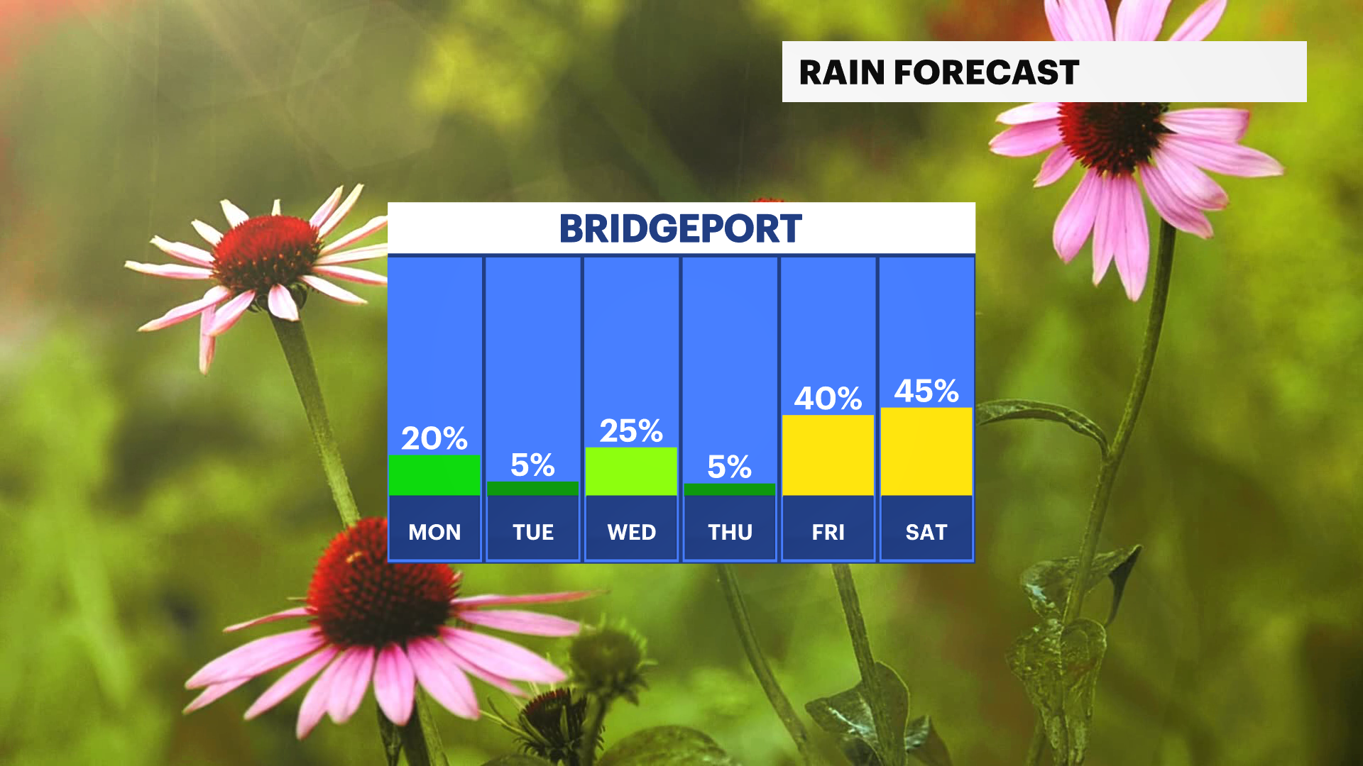
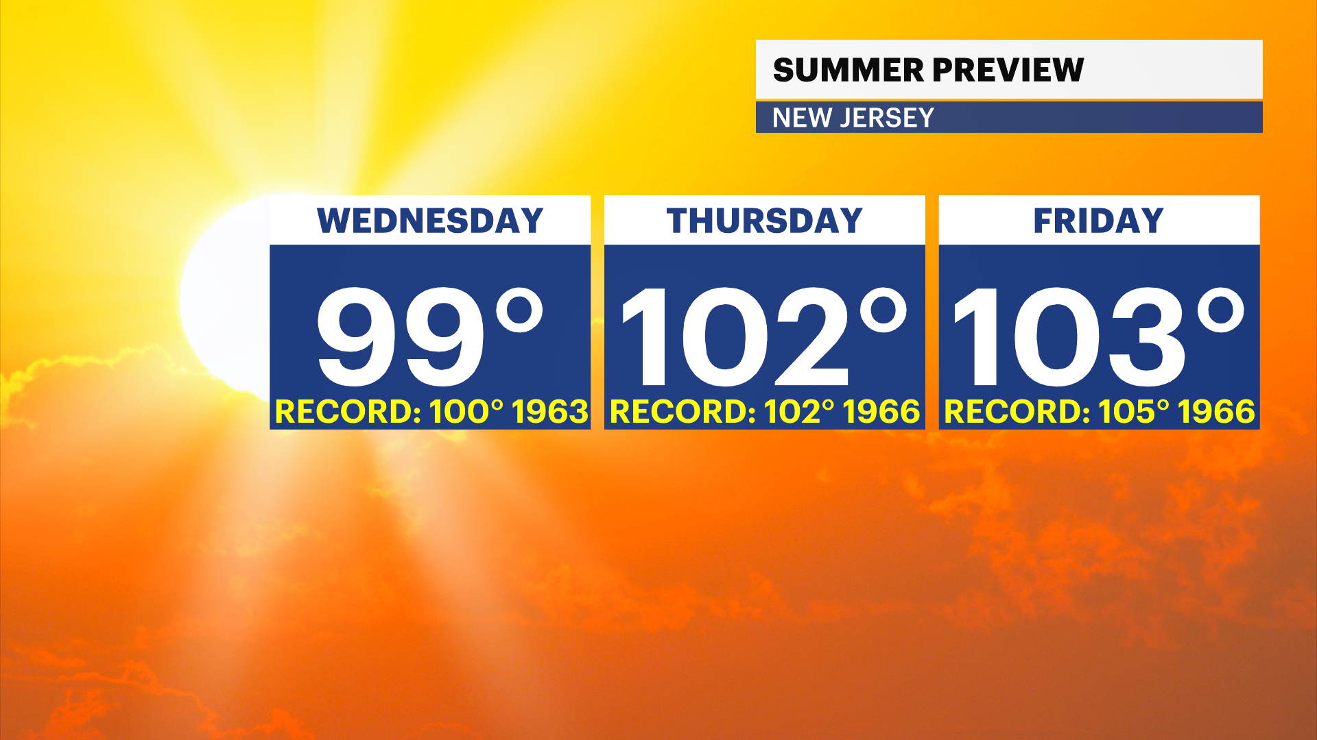
A prolonged heat wave is expected from midweek into the holiday weekend. The hottest days look to be Wednesday and Thursday, with temperatures climbing into the 90s and near 100 by Thursday. Little relief is expected Friday, and while not everyone will see rain, isolated afternoon and evening thunderstorms are possible late in the week as the hot and humid pattern becomes more unstable.
FORECAST:
Overnight: Cloudy skies, with temperatures in the low to mid-60s.
Monday: A mix of sun and clouds, with warm temperatures. Temperatures in the low to mid-80s.
Tuesday: Mostly sunny and warmer. Temperatures in the mid-80s.
Wednesday: Sunny, hot and increasingly humid. Temperatures in the low to mid-90s.
Thursday: Dangerous heat develops, with abundant sunshine. Temperatures near 100.
Friday: Hot and humid, with a chance for afternoon and evening thunderstorms. Temperatures near 100.
Saturday: Very warm, with scattered afternoon and evening thunderstorms possible. Temperatures in the mid-90s.
Sunday: Some relief arrives, but it remains warm. Temperatures in the mid- to upper 80s.