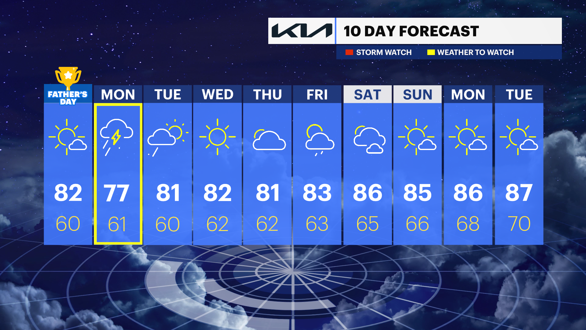
Partly sunny and warm Father's Day in the Hudson Valley before soaking rain arrives Monday
The Hudson Valley will see sunny skies and warm temperatures through Sunday, but a storm system will bring widespread rain, thunderstorms and the potential for localized flooding Monday into Monday night before sunshine returns midweek.
More Stories


What to Expect
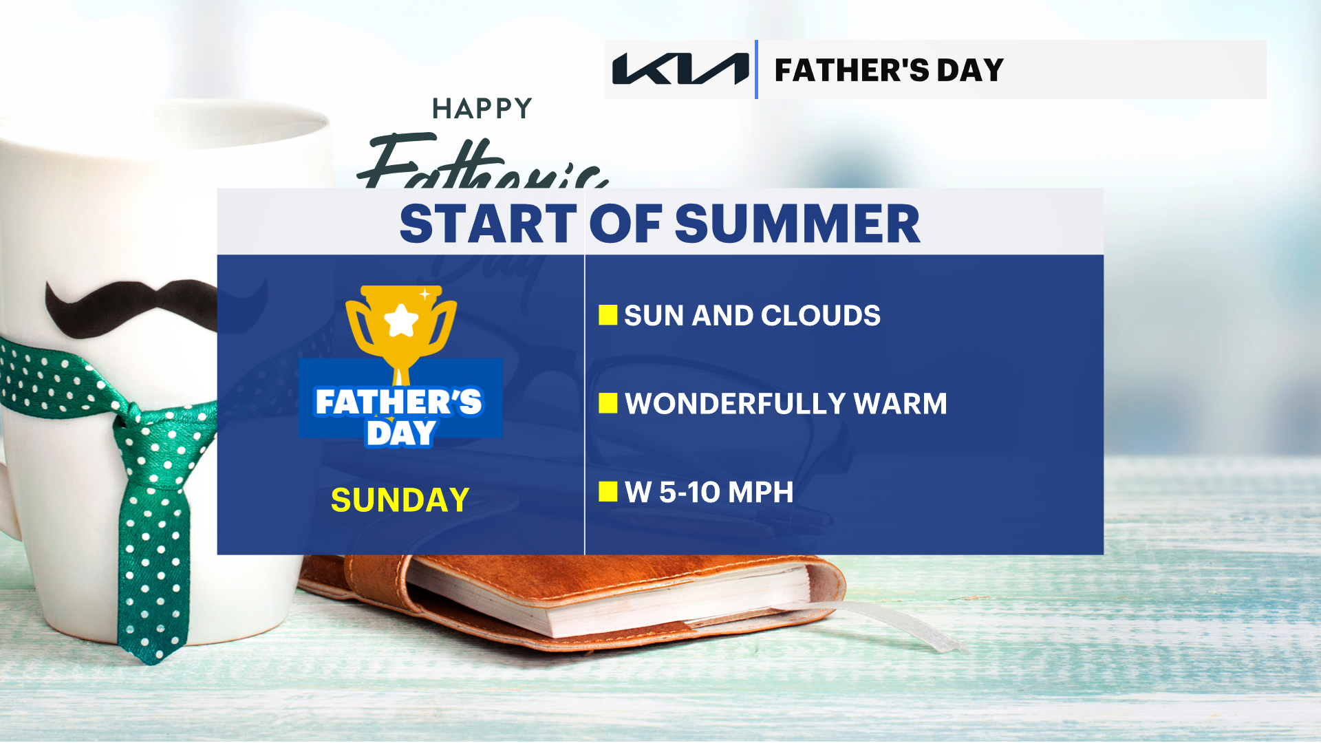
The remainder of the weekend will feature pleasant summer weather across the Hudson Valley, with comfortable humidity, seasonable temperatures and only a slight chance of an isolated afternoon shower or thunderstorm on Monday.
A much more active weather pattern develops Monday as a strong storm system moves into the region. Widespread rain, heavy downpours, and thunderstorms are expected Monday afternoon through Monday night. Rainfall totals of 1" to 2" will be common, with isolated higher amounts possible. Localized flooding of poor drainage areas, small streams and low-lying roads could develop where the heaviest rain falls.
Conditions improve Tuesday afternoon, with several days of dry, comfortable weather returning before another chance for showers arrives late Thursday into Friday.
Hudson Valley Forecast
Overnight:
Mostly clear and comfortably cool, with overnight temperatures falling into the upper 50s to around 60. Northwest winds will diminish, creating excellent sleeping weather with refreshing, low humidity.
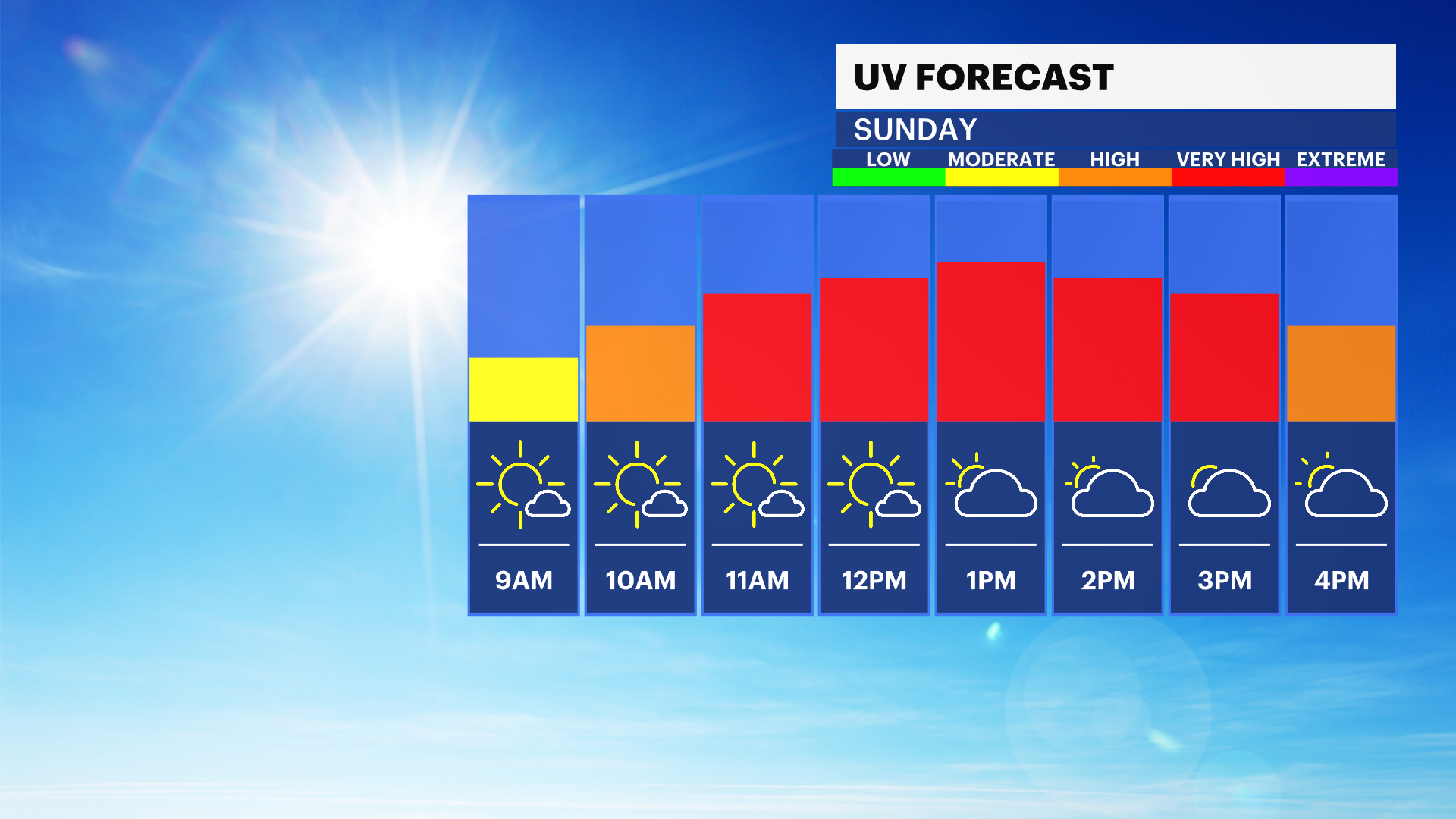
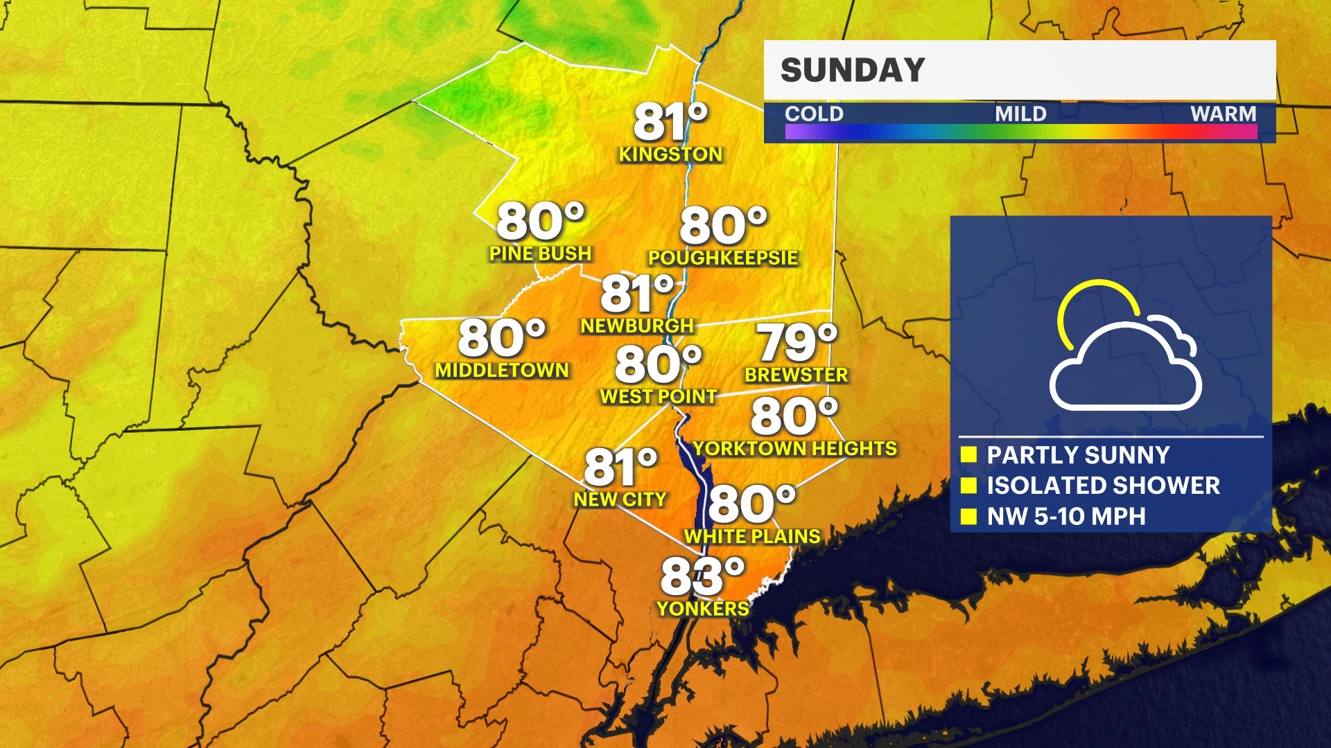
Sunday:
Mostly sunny and pleasant, with afternoon temperatures reaching the upper 70s to low 80s. Humidity remains comfortable, making it another excellent day for hiking, outdoor sports, picnics and other weekend activities. While an isolated shower or thunderstorm is possible late in the afternoon, most communities will stay dry.
Sunday Night:
Partly cloudy and comfortably cool, with overnight temperatures settling into the upper 50s to low 60s. Quiet weather continues as clouds gradually increase late at night ahead of Monday's approaching storm system.
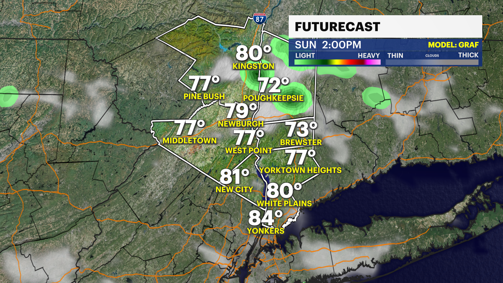
Monday:
Clouds increase quickly, with showers becoming widespread during the afternoon. Periods of heavy rain and a few thunderstorms are expected as temperatures reach the low to mid-70s. Rainfall will become steady at times, and localized flooding may develop in poor drainage areas and along small streams where the heaviest rain occurs. If you're traveling or commuting, plan for wet roads, slower travel and reduced visibility.
Monday Night:
Periods of rain and thunderstorms continue through much of the night, with heavy downpours remaining possible. Overnight temperatures will hold in the low 60s. Additional rainfall may produce localized flooding in areas that receive repeated rounds of heavy rain before precipitation gradually tapers toward Tuesday morning.
Tuesday:
Morning showers gradually diminish, followed by partial sunshine during the afternoon. Temperatures recover into the upper 70s to around 80. While a lingering shower is possible early, improving conditions will make for a much nicer finish to the day.
Wednesday:
Sunny and seasonably warm, with afternoon temperatures reaching the low to mid-80s. Comfortable humidity and abundant sunshine will make this one of the best weather days of the week for outdoor work, recreation and travel.
Thursday:
Mostly sunny through much of the day, with temperatures in the low 80s. Clouds increase during the afternoon, bringing a chance for scattered showers later in the day. Most daylight hours should remain dry.
Friday:
Partly sunny, with a chance of scattered showers. Afternoon temperatures remain in the low to mid-80s. It won't be a washout, but keep an umbrella nearby if you'll be spending time outdoors.
Saturday:
Mostly sunny and pleasantly warm, with temperatures in the low to mid-80s. Comfortable humidity and plenty of sunshine should provide another excellent summer day across the Hudson Valley.