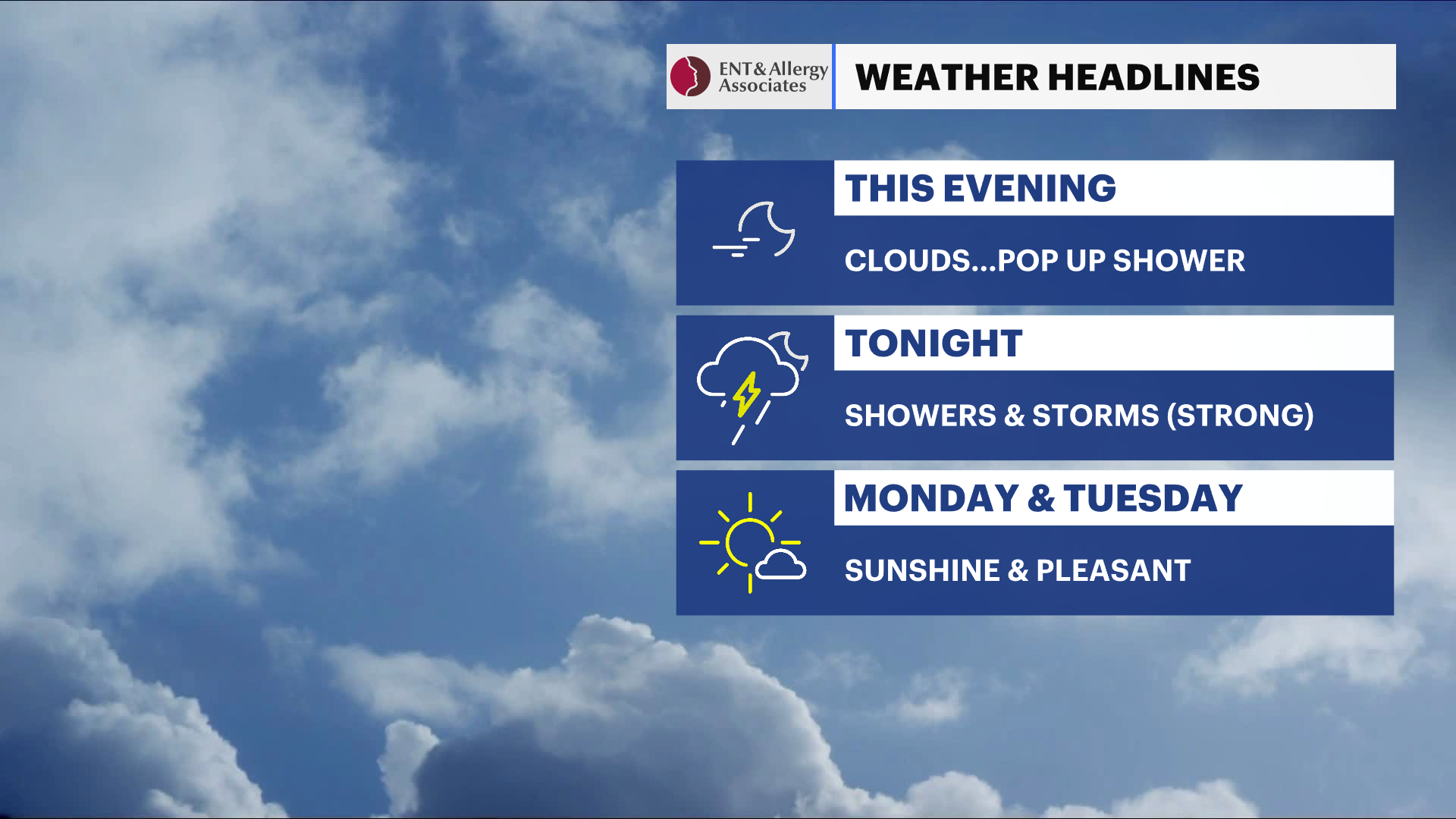
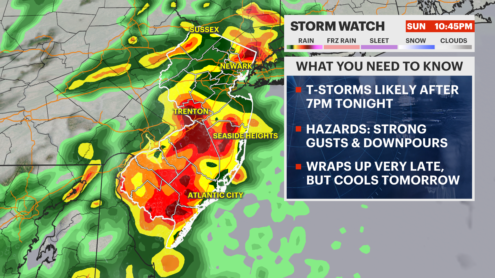
STORM WATCH: Stormy Sunday night, then beautiful stretch of summer weather for the Hudson Valley
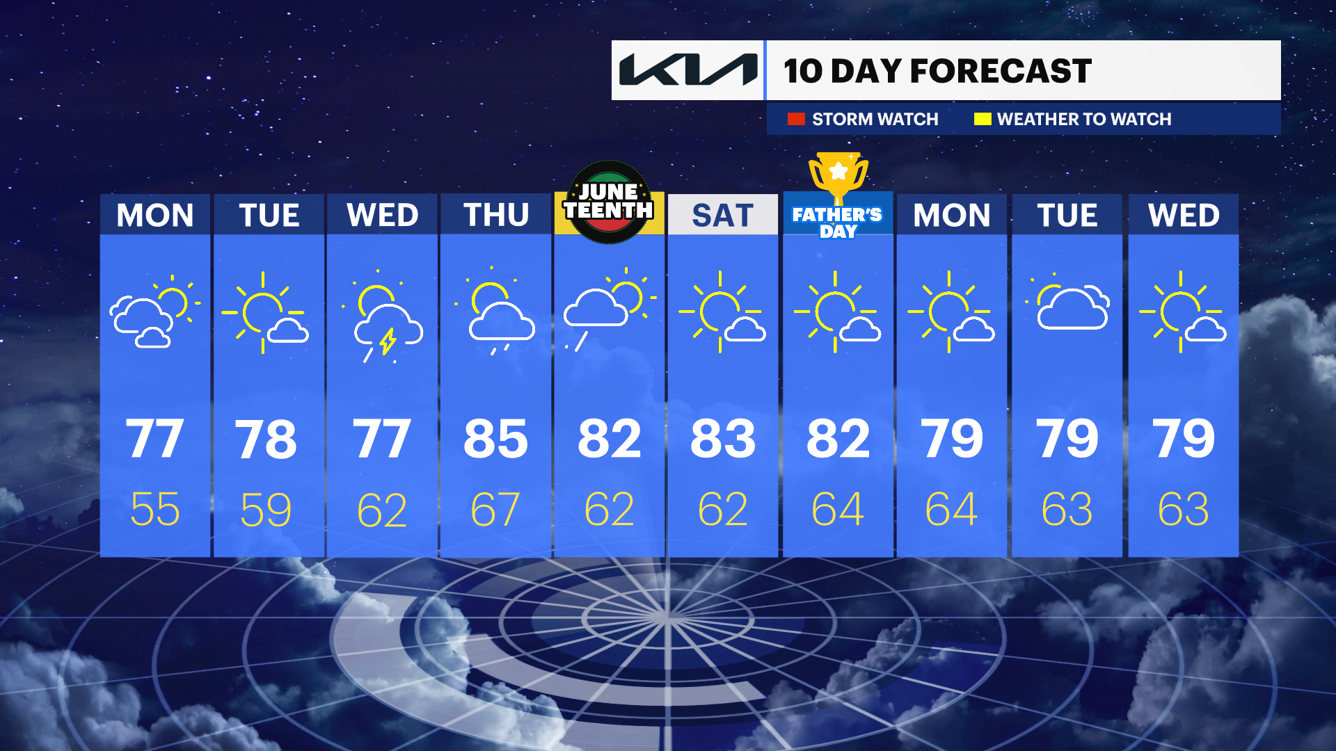
Strong thunderstorms may impact the Hudson Valley Sunday night before sunshine, lower humidity and comfortable temperatures dominate through midweek. Another round of showers and storms could arrive late Thursday into Friday before warm summer weather returns next weekend.
More Stories


What to Expect
The primary weather concern will be Sunday night's showers and thunderstorms, with some storms capable of producing damaging wind gusts and brief heavy rainfall. Once the cold front passes, a much more comfortable air mass arrives for Monday through Wednesday, bringing sunshine, lower humidity and seasonable temperatures.
Attention then turns to late week as another stronger weather system approaches. Shower and thunderstorm chances increase Thursday into Friday, potentially impacting Juneteenth holiday plans. By next weekend, warm summer weather appears likely to return, with temperatures approaching 90.
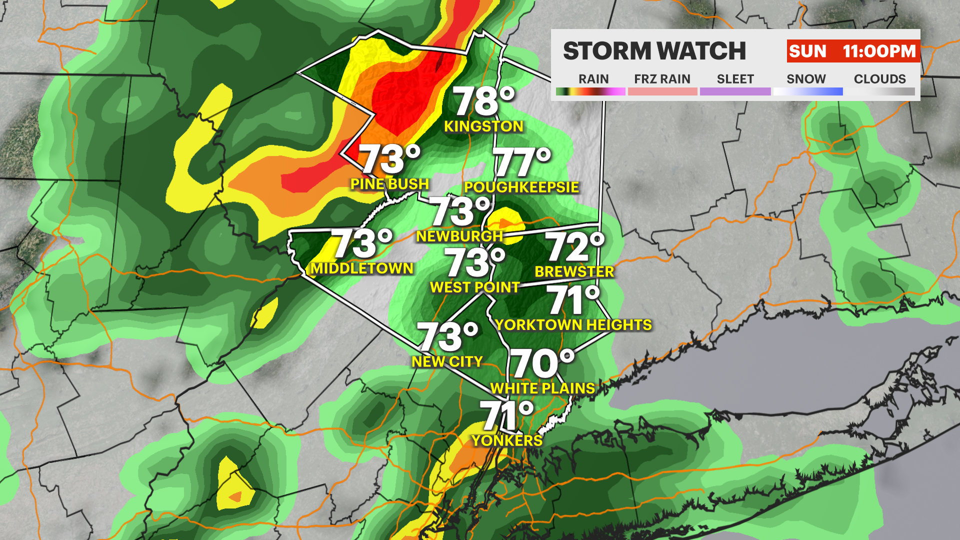
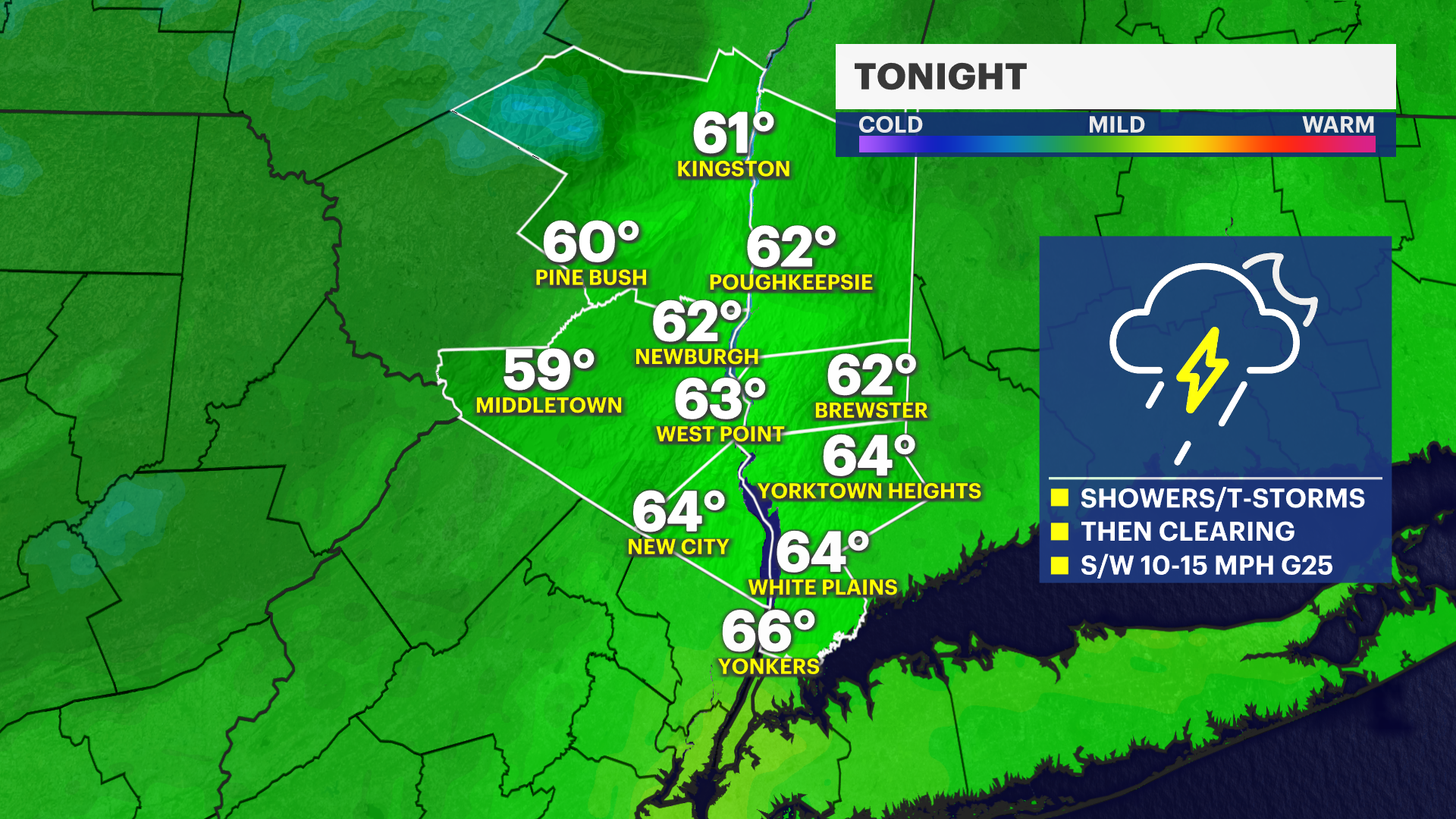
Sunday Night:
An active weather night is expected across the Hudson Valley as showers and thunderstorms become more widespread through the evening and overnight hours. Some storms may become strong to severe, especially during the evening, with damaging wind gusts posing the primary threat. Frequent lightning and brief torrential downpours are also possible.
While widespread flooding is not anticipated, localized poor-drainage flooding and ponding of water on roadways could occur where heavier rainfall develops. Temperatures remain mild overnight, only falling into the lower to mid-60s. If you have evening travel plans, be prepared for rapidly changing weather conditions.
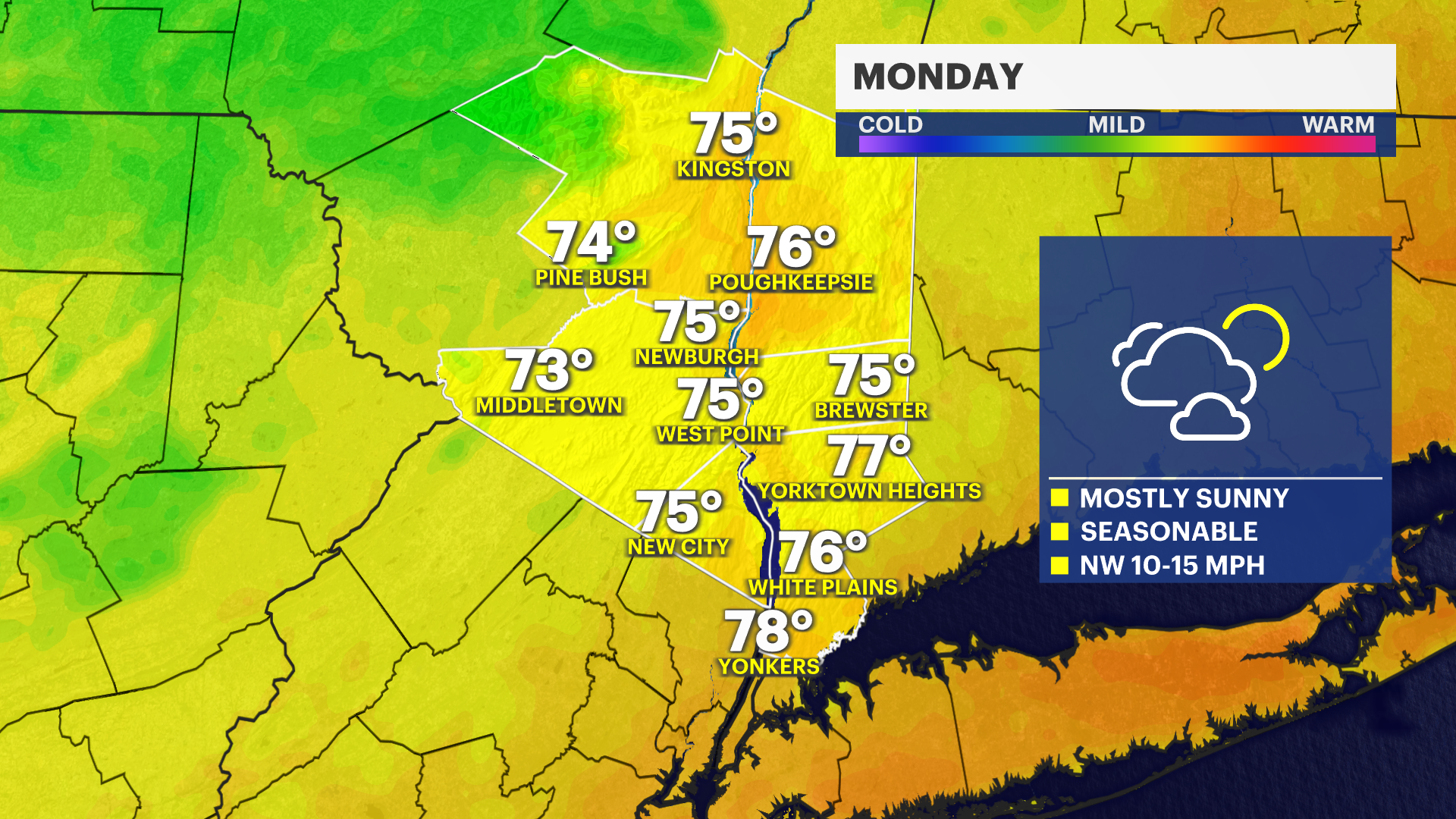
Monday:
A few lingering showers may be possible early in the morning, but skies will gradually clear through the day. Temperatures will top out in the upper 70s to low 80s with noticeably lower humidity.
Conditions will be excellent for outdoor activities like yard work, hiking and travel by the afternoon. The air will feel much more comfortable compared to the warm and increasingly humid conditions of the weekend.
Monday Night:
Mostly clear and comfortably cool, with temperatures falling into the mid- to upper 50s. Great sleeping weather returns to the region.
Tuesday:
Sunny and pleasant, with highs reaching the upper 70s to low 80s. Humidity remains low and conditions will be nearly ideal for outdoor recreation, sports and other summertime activities.
Wednesday:
Mostly sunny and seasonably warm, with highs around 80. Comfortable humidity levels continue and no significant weather issues are expected.
Thursday:
Partly sunny, warmer and increasingly humid with highs climbing into the low to mid-80s. A chance of showers develops during the afternoon as the next weather system approaches.
While much of the day may remain dry, periods of rain become more likely later in the day and into the evening. Outdoor plans may encounter some interruptions, especially later in the afternoon.
Friday (Juneteenth):
Partly sunny, warm and somewhat humid, with highs reaching the mid- to upper 80s. Scattered showers and thunderstorms remain possible, particularly during the afternoon and evening. Forecast details will become clearer over the next few days, but residents should remain alert for updates if planning outdoor holiday activities.
Saturday:
Sunny and warm, with highs ranging from the upper 80s to near 90. Humidity levels appear manageable, making for a great day for outdoor activities, festivals, hiking, boating and recreation throughout the Hudson Valley.