Possible record warmth on tap for tomorrow, with rain and storms that won't cool us off
Tomorrow kicks off another stretch of 90-degree heat. If we pull together three consecutive days, it will be our fourth heatwave this summer.
More Stories


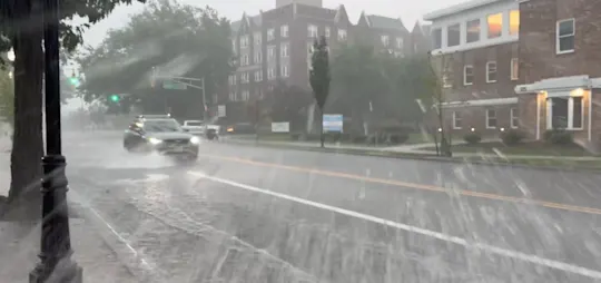


This summer really hasn't been that extraordinarily hot. If this weeks forecast comes together and we get three maybe four days of 90 degree plus weather, it will be only our 4th heatwave of the season. Last year, July alone had four heatwaves.
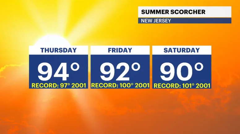
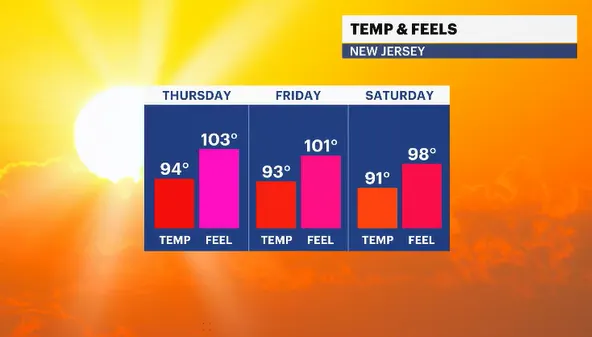
On top of the above-average temperatures, possibly record-breaking tomorrow depending on cloud coverage, the humidity will make New Jersey feel like a sauna. The expected feels-like temperature could range from 100 to 105 degrees. Pool day, beach day, lake day, stay inside all day - pick one!
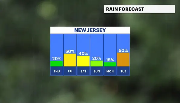
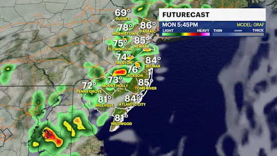
With such a warm environment, it won't take much for a shower or renegade thunderstorm to fire up. Don't cancel any outdoor plans. Just plan for the opportunity for such a development. The remainder of the work/ vacation week features the heat, the humidity and the chance for late-day storms. This is very typical of early August.
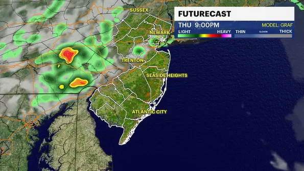
The weekend right now still looks very warm with afternoon highs near 90 degrees and very humid. Rain or storm chances are still possible for Saturday but diminishing quite a bit for Sunday. Forecasting fingers crossed the weekend rain chances continue to drop.