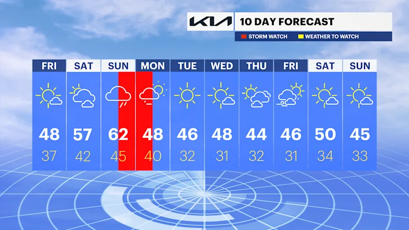
STORM WATCH: Heavy rain, gusty winds moving in for Sunday night
The National Weather Service has issued a flood watch for late Sunday through early Monday.
More Stories




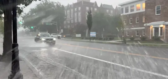

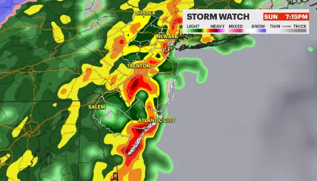
The weekend forecast is still on pace to see significant rain and wind toward the end of Sunday.
The National Weather Service has issued a flood watch for late Sunday through early Monday. One to two inches of rain will fall in a short amount of time which will cause water to collect on streets. The majority of the weather happens during the overnight hours between 11 p.m. and 4 a.m.
There is some suggestion from guidance that as the storm passes through very early Monday morning there may be a quick changeover to snow showers in the northwest corner of the state. This is something that will need to be watched.
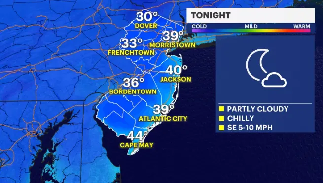
TONIGHT: Clear to partly cloudy. Mild. Low around 40.
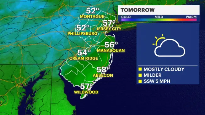
SATURDAY: Partly sunny skies. Dry and warm. High near 60.
SUNDAY: Story weather for the nighttime hours lasting into Monday morning.
MONDAY: Morning could be slippery in spots, but I'm also expecting rapid improvement. Breezy and colder temperatures.
The rest of the week looks dry and sunny but also on the chillier side.
___
What we know about Sunday's storms
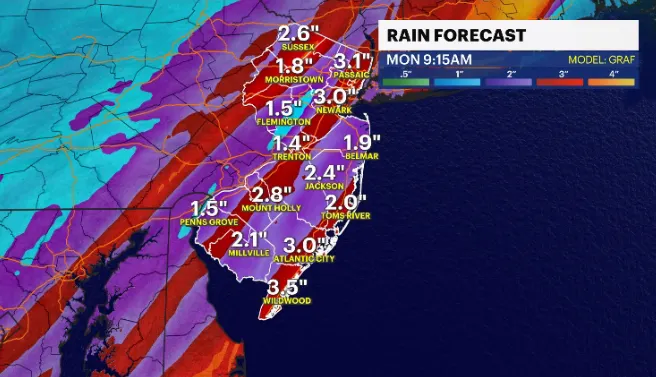
WHAT: A squall of thunderstorms is expected Sunday evening to deliver downpours and strong gusts of 30-50 mph. On and off showers are expected likely before the squall's arrive, with some communities remaining unexpectedly dry as they dodge the passing rain. It will abruptly improve after the squall passes overnight. Temperatures will fall also and Monday starts fair but breezy. Widespread area flooding and isolated flash flooding is expected with 2-3" of rainfall predicted.
WHEN: Sunday 1 p.m. - Monday 4 a.m.
Sunday 1 p.m.: Showers will be on and off, not hitting everyone at once.
Sunday 7 p.m.: Area flooding likely begins, embedded downpours within the scattered showers.
Sunday 10/11 p.m.: Thunderstorm Squall arrives to western areas, downpours, strong gusts, near severe thresholds, and an isolated rumble of thunder. Flash flooding can happen if downpours move over the same areas from earlier in the day or if rainfall rates are incredibly high, which is possible.
Monday 4 a.m.: Thunderstorm squall leaves the coast and moves offshore. Worst wind takes place overnight for Monmouth and Ocean counties.
WHERE: The worst of the wind will be east of the Parkway in Monmouth and Ocean counties. There will be widespread gusts of 30-45 mph, but the coastal gusts can exceed 45-50 mph+. Rainfall is widespread 2", but isolated communities can see 3"+ if downpours repeat their path.