Storm bringing snow to parts of NJ; wintry mix and rain for other areas
A storm is bringing snow, sleet and rain to the Garden State to wrap up the first weekend of 2021.
•
Jan 4, 2021, 4:05 AM
•
Updated 1,342 days ago
Share:
More Stories

Power center: Electric outage resources
156ds ago
Guide: Tips for avoiding car damage from potholes
185ds ago
Guide: Tips to keep yourself and your loved ones safe from carbon monoxide poisoning
199ds ago0:55

IT’S TIME TO SHOVEL! 10 tips to help you dig out safely
207ds ago0:38

25 tips to keep you safe during a winter storm
208ds ago0:53

Guide: How to protect yourself from extreme cold
208ds agoPower center: Electric outage resources
156ds agoGuide: Tips for avoiding car damage from potholes
185ds agoGuide: Tips to keep yourself and your loved ones safe from carbon monoxide poisoning
199ds ago0:55
IT’S TIME TO SHOVEL! 10 tips to help you dig out safely
207ds ago0:38
25 tips to keep you safe during a winter storm
208ds ago0:53
Guide: How to protect yourself from extreme cold
208ds agoA storm is bringing snow, sleet and rain to the Garden State to wrap up the first weekend of 2021.
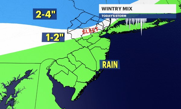
The National Weather Service has issued a winter weather advisory for northwestern New Jersey, including areas of Sussex, Hunterdon, Morris, Somerset and Warren counties through 1 a.m. Monday.
News 12 meteorologists say we're seeing a second round of snow, wintry mix and rain through the evening. Areas seeing snow can expect another 1-2" on top of what fell earlier.
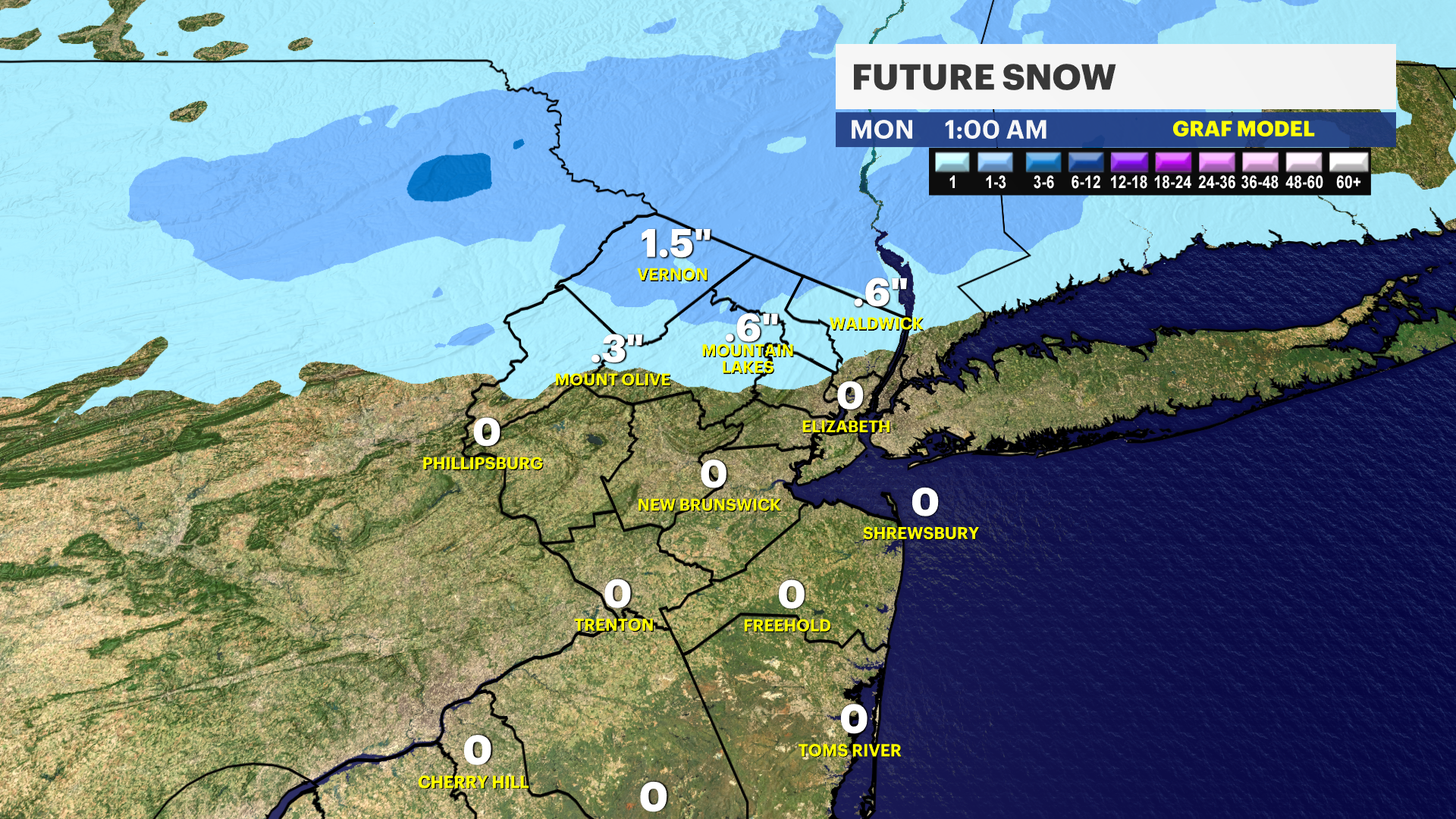
The snow is staying generally north of I-78 with accumulations mainly north of I-80 and in spots with higher elevations.
Temperatures are borderline freezing so we can expect slippery spots on untreated surfaces up north.
Temperatures will not fall tonight, they hold steady in the lower 30s north and mid 30s south. So unless your area already had frozen precipitation, it will not freeze over tonight. We have warmer temperatures tomorrow too.
The precipitation will taper off by around midnight.
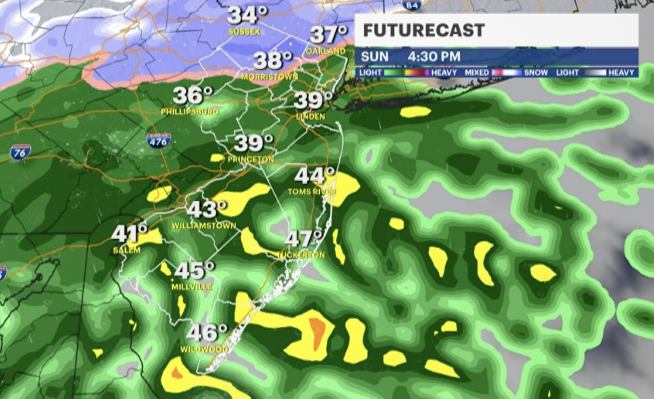
Conditions clear up for Monday, with highs around 43 and partly sunny skies -- kicking off a more tranquil stretch of weather for much of the week.
But News 12 meteorologists are tracking a chance for another potentially bigger storm next Saturday, so stay with us for the very latest forecast information.
More from News 12
1:50

Family of man killed while riding scooter in Elizabeth says they ‘want justice’
2:30

Chilly morning, pleasant afternoon Sunday in New Jersey
0:33

Officials: 2 dogs killed, FedEx truck destroyed in separate South Brunswick fires
0:15

Authorities probe alleged social media threat made by Paramus High School student
0:13

Police: Green Brook man wanted for questioning in Newark shooting incident
2:16
