WEATHER TO WATCH: Tracking potential nighttime thunderstorms
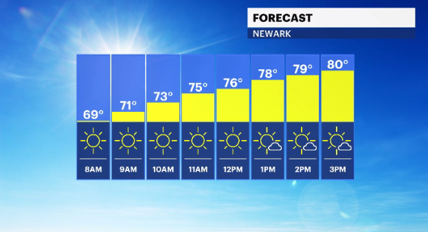
Summer may be ending soon, but New Jersey will continue to see summerlike temperatures for the first half of the week.
•
Sep 19, 2022, 9:51 AM
•
Updated 759 days ago
Share:
More Stories
1:45

How to spot the A3 comet before it disappears into the cosmos
2ds ago1:54

Replacement for beloved Morris Plains whistle in the works
5ds ago1:01

Somerset County students launch weather balloon to study climate change
6ds ago1:57

Thousands flee Florida for New Jersey as Hurricane Milton approaches
10ds ago1:44

‘A way to give back.’ Jersey Aero Club sends tons of aid to Hurricane Helene victims
11ds ago5:45

Milton gains strength in Gulf of Mexico as Florida prepares for another major storm
11ds ago1:45
How to spot the A3 comet before it disappears into the cosmos
2ds ago1:54
Replacement for beloved Morris Plains whistle in the works
5ds ago1:01
Somerset County students launch weather balloon to study climate change
6ds ago1:57
Thousands flee Florida for New Jersey as Hurricane Milton approaches
10ds ago1:44
‘A way to give back.’ Jersey Aero Club sends tons of aid to Hurricane Helene victims
11ds ago5:45
Milton gains strength in Gulf of Mexico as Florida prepares for another major storm
11ds agoSummer may be ending soon, but New Jersey will continue to see summerlike temperatures for the first half of the week.
Storm Watch Team meteorologists are tracking potential thunderstorms that could produce heavy rain and lightning into the overnight hours.
WHAT’S NEXT: Chance of isolated thunderstorms between 5 p.m. and 1 a.m. Storms may produce heavy rain. Chance for severe storms to develop.
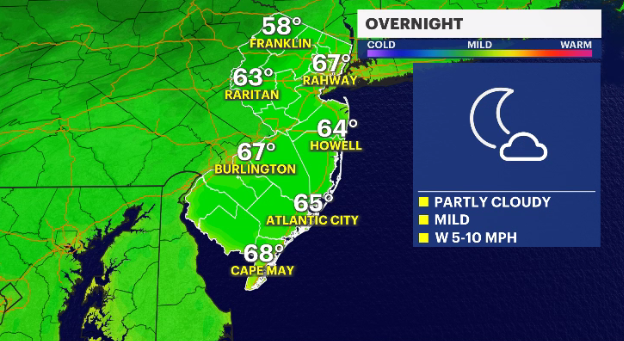
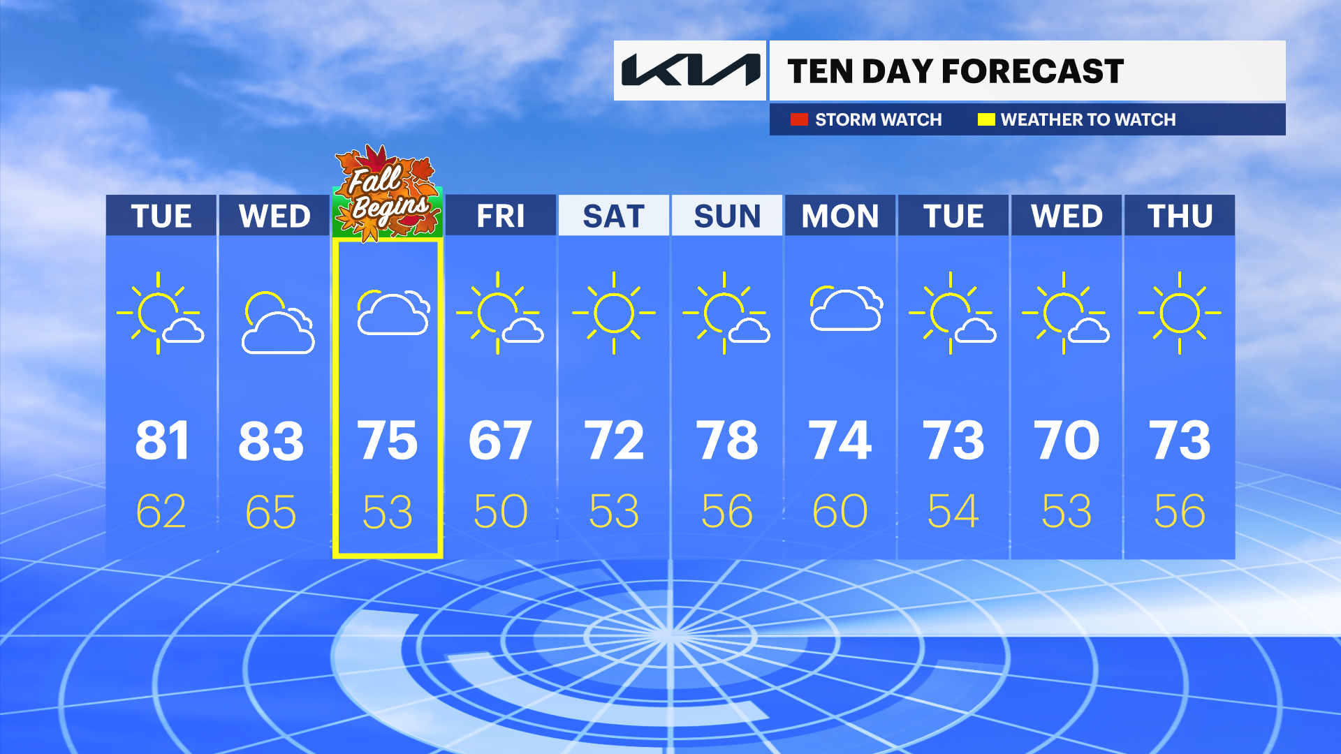
TUESDAY: Mostly sunny skies, with some clouds. Daytime highs around 81 degrees. Overnight lows cool into the low-60s.
WEDNESDAY: Mix of sun and clouds with daytime highs around 83 degrees. Chance for showers Wednesday night, into early Thursday morning. Overnight lows around 65.
THURSDAY: First day of fall. Mostly cloudy skies. Daytime highs in the mid-70s, with overnight lows around 53 degrees.
FRIDAY: Mostly sunny skies, with some clouds. Daytime high around 67 degrees. Overnight lows in the upper-40s and low-50s.
More from News 12
2:00

All East Orange schools to run on half-day schedule on Friday following heated meeting with officials
2:53

Autumn air sticks around for one more day in New Jersey
1:08

ANCHOR benefit website down until Oct. 23 for maintenance
1:43

JCP&L: Squirrel causes power outage in Monmouth County for 2nd time in as many months
0:30

Prosecutor: 2 nursing assistants accused of critically injuring patient in assault
0:40
