Warmer start to the week for Connecticut; midweek rain is expected
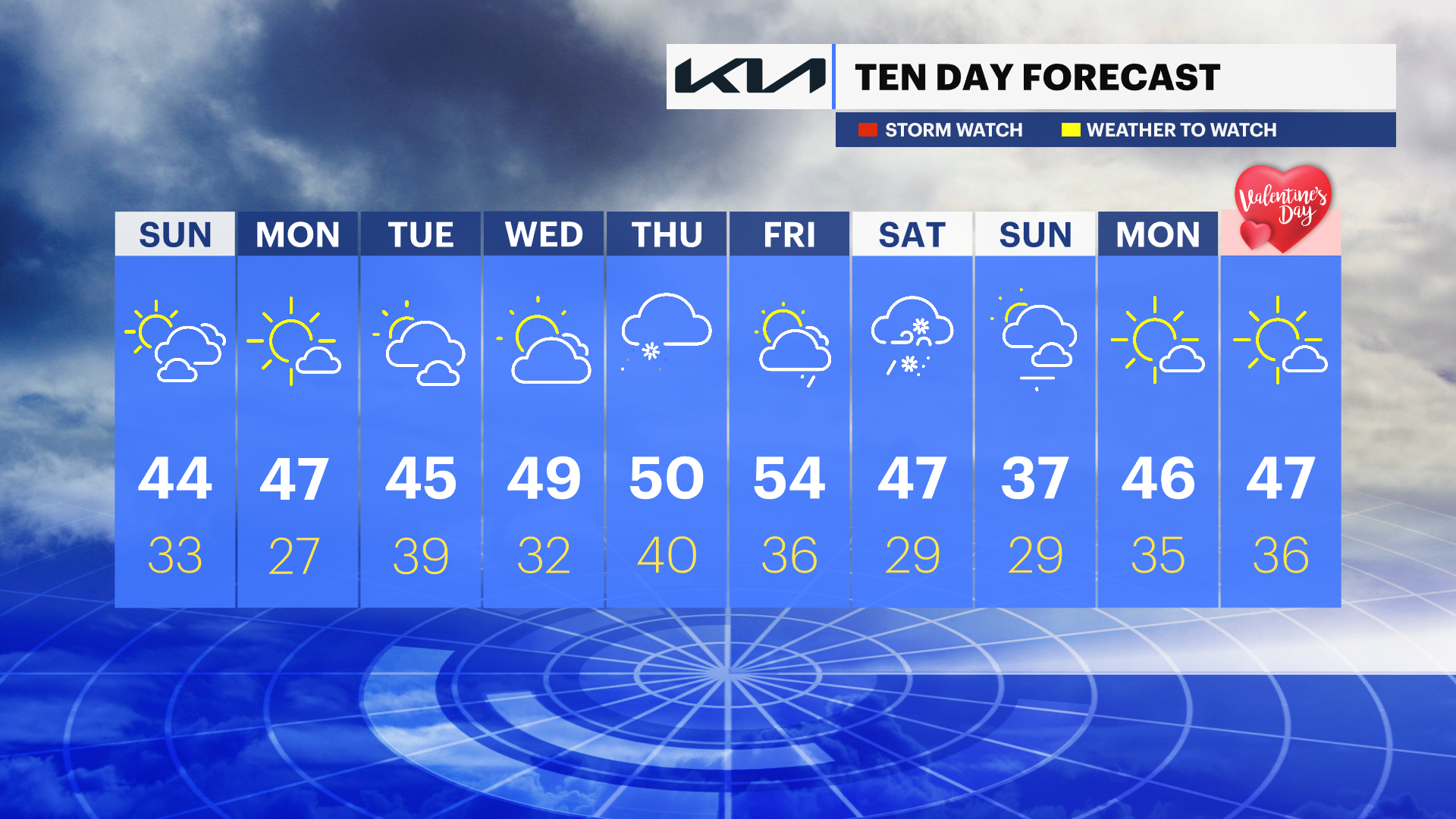
News 12 Storm Watch Team Meteorologist Michele Powers says a warmer-than-average workweek is ahead with mild conditions in the 40s and 50s. Rain chances return Thursday with even some possibilities for ice and snow mixed into wrap up the week.
News 12 Staff
•
Feb 5, 2023, 12:25 PM
•
Updated 455 days ago
Share:
More Stories
2:10
Foggy, dreary start with rogue rain showers today in New Jersey
1h ago1:01

LIVE BLOG: News 12 weather updates
3h ago2:10
Cloudy with passing showers for Monday in New Jersey
9h ago2:10
Mostly sunny Friday ahead with cooler temperatures; tracking weekend rain
3ds ago2:10
Beautiful Thursday weather ahead; clouds and rain develop by the weekend
4ds ago2:10
STORM WATCH: Tracking evening thunderstorms expected to impact New Jersey
5ds ago2:10
Foggy, dreary start with rogue rain showers today in New Jersey
1h ago1:01
LIVE BLOG: News 12 weather updates
3h ago2:10
Cloudy with passing showers for Monday in New Jersey
9h ago2:10
Mostly sunny Friday ahead with cooler temperatures; tracking weekend rain
3ds ago2:10
Beautiful Thursday weather ahead; clouds and rain develop by the weekend
4ds ago2:10
STORM WATCH: Tracking evening thunderstorms expected to impact New Jersey
5ds agoNews 12 Storm Watch Team Meteorologist Michele Powers says a warmer-than-average workweek is ahead with mild conditions in the 40s and 50s. Rain chances return Thursday with even some possibilities for ice and snow mixed into wrap up the week.
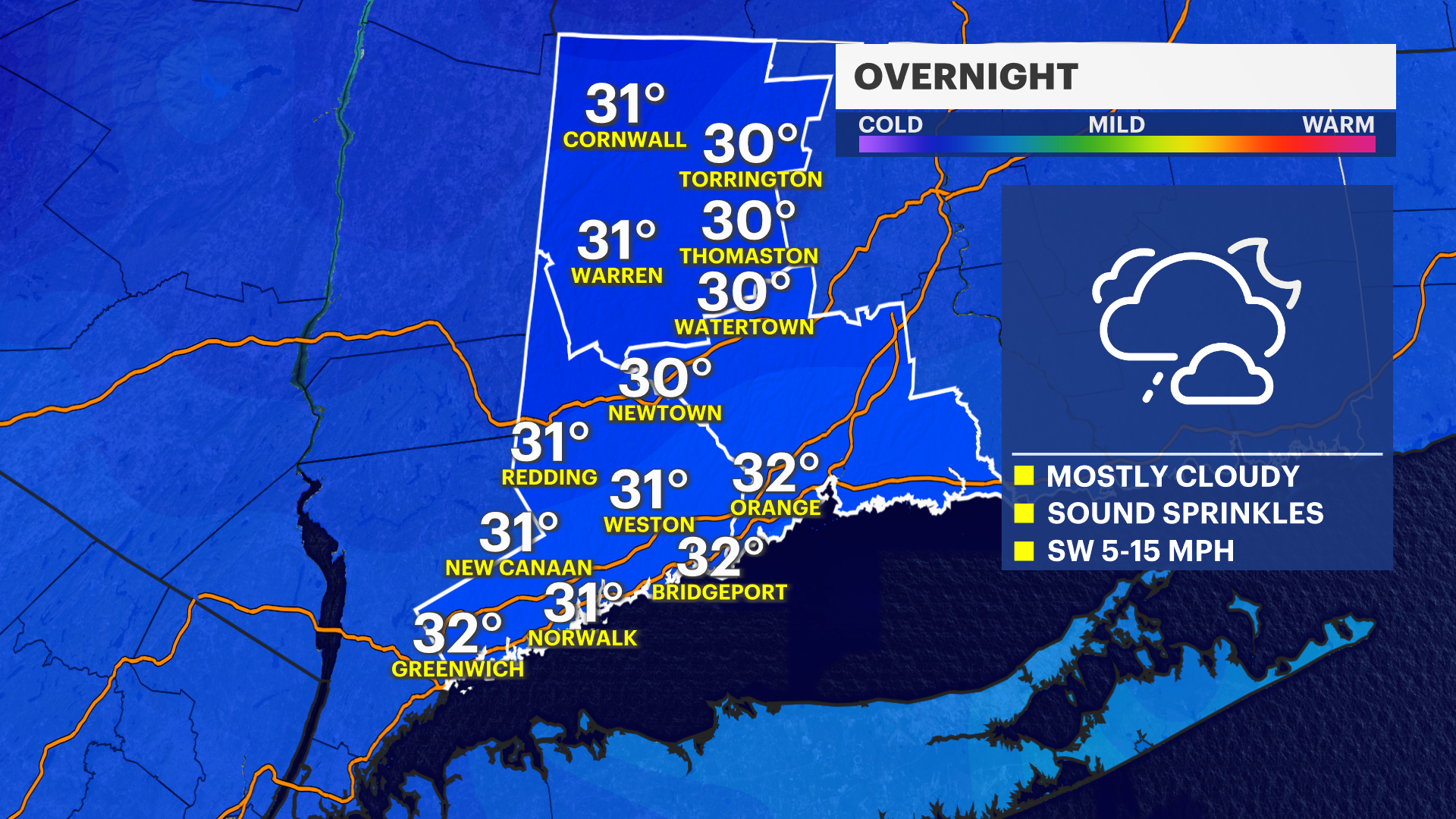
OVERNIGHT: Sprinkles along the Long Island Sound into Monday morning. Lows in the 30s. Wind 5-10 mph
MONDAY: Turning mostly sunny with highs in the 40s. Wind 5-15 mph.

TUESDAY: Partly cloudy with showers possible overnight. Highs in the 40s and the lows near 40.
WEDNESDAY: Increasing clouds. Highs around 50 with lows around freezing.
THURSDAY: Mostly cloudy with a shower chance. Mix possible early in Fairfield and Litchfield counties. Highs in the 50s.
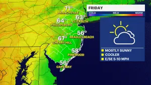
FRIDAY: Partly cloudy with a shower chance late. Highs in the 50s.
SATURDAY: Rain or snow showers possible. Breezy. Highs in the 40s.
SUNDAY: Partly cloudy and breezy. Highs in the 30s.